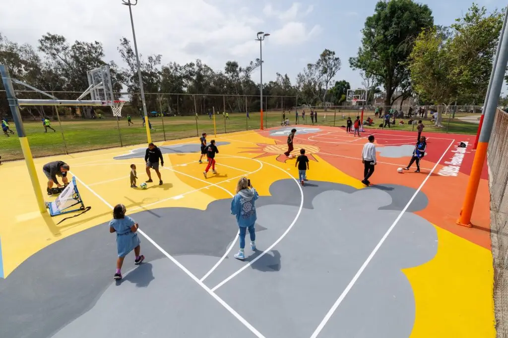
This fun loop takes you across all seven pedestrian bridges around Balboa Park. Start in Balboa Park’s Rose Garden, and take the bridge over Park Boulevard. Walk west through the park to the Cabrillo Bridge over the 163. Keep going on Laurel Street until First Avenue, then turn right to go over the First Avenue Bridge. Take a right on Quince Street and cross the Quince Street Bridge. From there, turn left on Fourth Avenue, another left on Spruce Street, and you’ll find the Spruce Street Suspension Bridge. It’s a long way to the next one: Make your way back north and east to University Avenue. (If you hit Sixth Avenue first, just head north). Take University east (you’ll cross over the 163 again, but that bridge doesn’t count!) to Vermont Street and turn left. Past the Trader Joe’s you’ll find the Vermont Street Bridge. On the other side, turn right on Lincoln Avenue and head all the way to Georgia Street, turn right again and take the short Georgia Street Bridge over University Avenue. Last is a right on Robinson Street and a left on Park Boulevard to get back where you started.
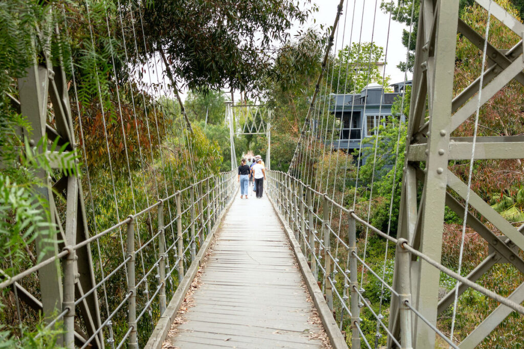
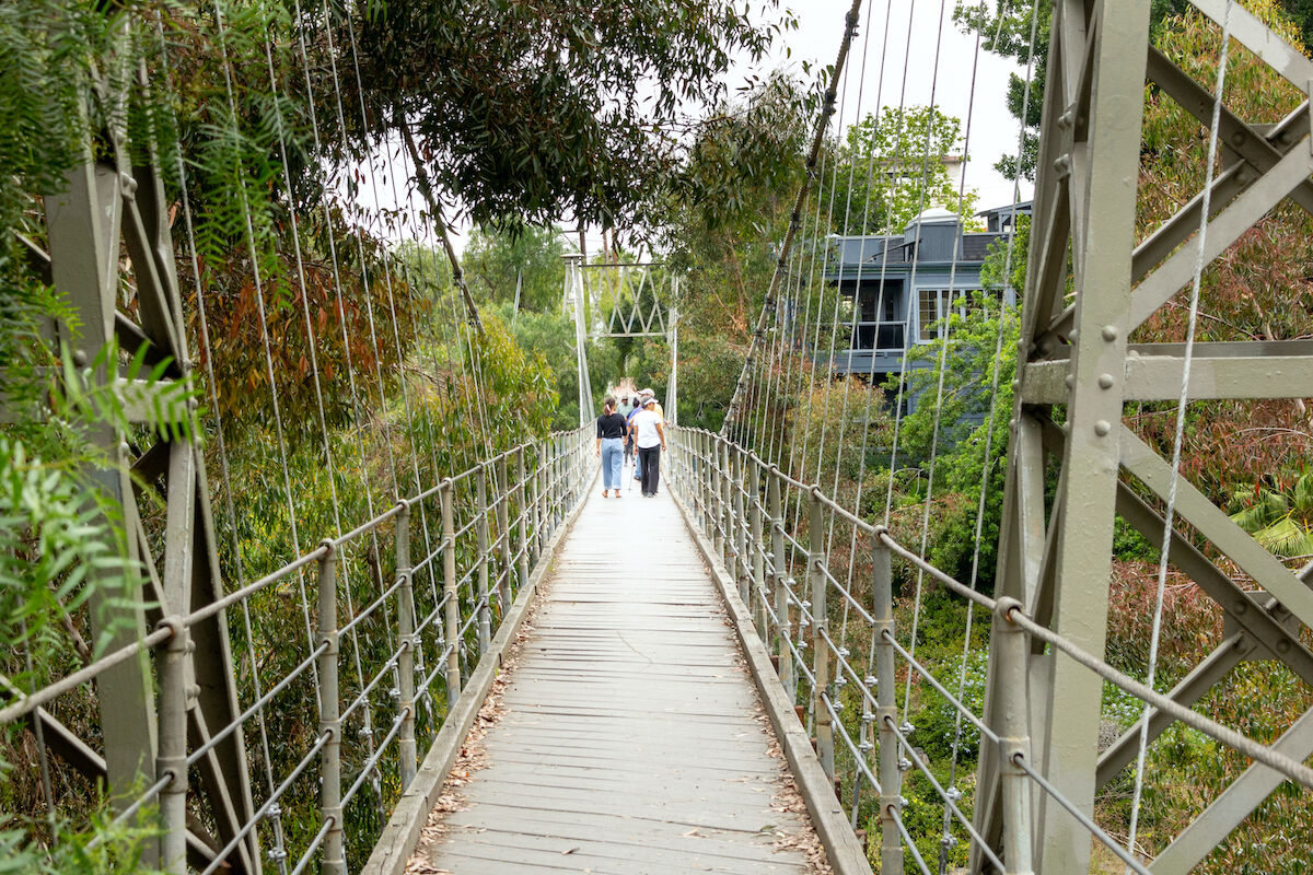
Explore the new bike paths and pedestrian bridges around the UC San Diego campus while taking a tour of the medical and research buildings in the area. This route includes several protected bike paths fully off the road. Start at the northwest corner of Westfield UTC mall and head north along Genesee Avenue. As soon as you cross over I-5, you’ll see a bike path crossing over Genesee that you can take south until you hit Voigt Drive on the UCSD campus. Then, just follow the path through campus and over the two-toned pedestrian bridge (pictures of the bridge or it didn’t happen) to join Miramar Street, then it’s a straight shot east back to your start. When you’re done, treat yourself to one of UTC’s many dining options—True Food Kitchen, Queenstown Bistro, and Great Maple are all local favorites with outdoor seating and a variety of lunch options.
Urban Trails map
Katie Hart
Silver Strand Bike Path
DIFFICULTY LEVEL: Hard
LENGTH: 24 miles for the loop
DOG-FRIENDLY: Yes
STROLLER-FRIENDLY: Yes
PAY TO PARK: No
This path offers a long, flat run or ride with views of the ocean and marshes that stretch as far as you are willing to go. Start in Coronado on the south side of the intersection of Glorietta Boulevard and Pomona Avenue. The path leads south along Pomona, continues onto the Silver Strand, and around the south end of the bay. From there, on-street bike lanes head north to complete the 24-mile loop, or turn back to stay on the dedicated bike path. When you’re done, get drinks on the patio of the Hotel Del.
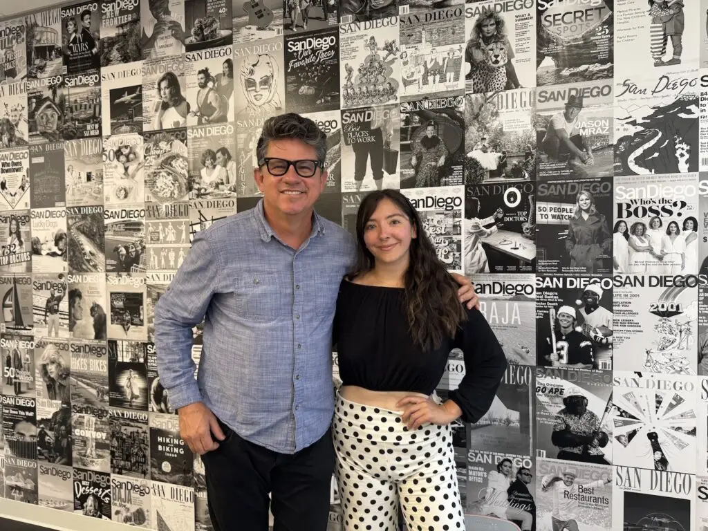
Claire Trageser has been writing for San Diego Magazine for 10 years. She also is a reporter at KPBS and writes for The New York Times, National Geographic, Marie Claire, Elle and Runner's World.
For thousands of years, the Kumeyaay who lived in this area called a mountain south of Julian Cush-pii, meaning “sharp peak.” Then, after the Civil War, Confederate sympathizers saw that same mountain and decided to rename it Stonewall Peak—after General Stonewall Jackson. The name stuck for nearly a century and a half, until Cuyamaca Rancho State Park announced earlier this year that the name will return to its original, Cush-pii. Hike to the summit for expansive views of the Coronado Islands to the west and Mexico to the south.
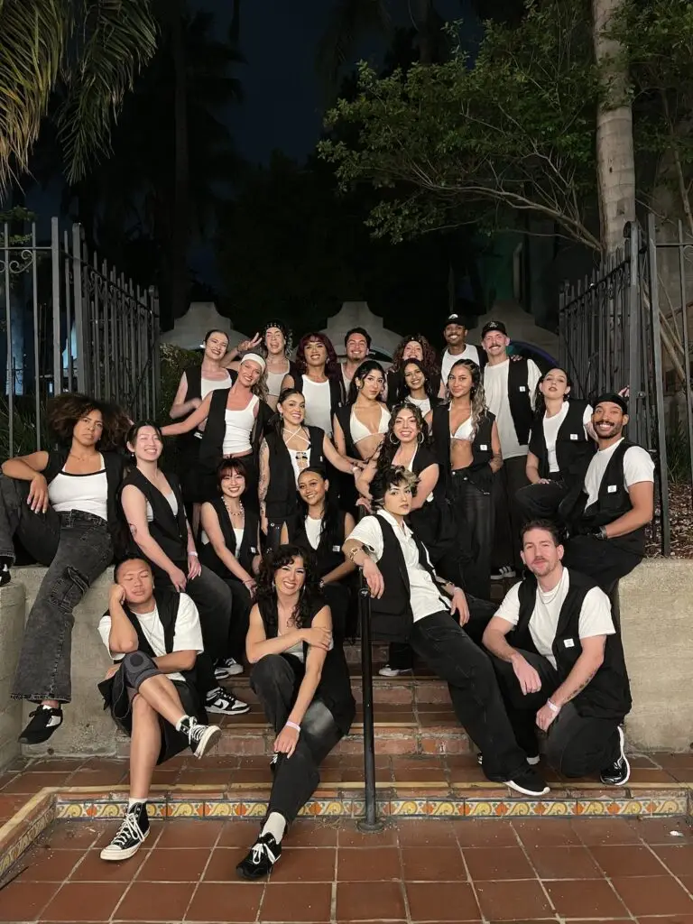
Courtesy of Culture Shock San Diego
Best Pop and Lock Spot
Culture Shock
In 1993, Angie Bunch gathered a group of hip-hop dancers—called Culture Shock Dance Troupe—and gave them a space to practice and perform. As hip hop grew through the ’90s, so did Culture Shock. It has since become a nonprofit, a space for young and old, beginner and expert dancers. Culture Shock has also expanded to Los Angeles, Oakland, Las Vegas, Chicago, Atlanta, New York City, and Washington, D.C., as well as Ottawa and Toronto, Canada.
In 2019, Amanda Leach created the Yoga Box method, which takes high-energy flows and adds strength-building poses in heated, vibey, lava-lamp-lit studios. What started on Grand Avenue in Pacific Beach has spread to 15 locations across the county, with even more trickling into Denver, Chicago, and Brooklyn. The best part? Mindfulness newbies who can’t touch their toes and six-packed contortionists can hang in the same class. You can customize each session based on your ability and fitness level.
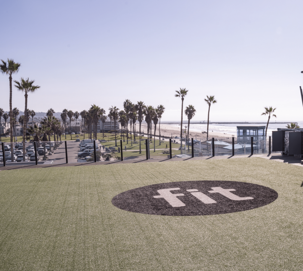
Courtesy of Fit Athletic Club
Best Leg Day Turned Social Hour
Fit Mission Beach
A gym taking over a historic beachfront pool sounds like the setup for a new season of Love Island, but Fit Mission Beach operating the nearly 100-year-old Plunge at Belmont Park is real. The independent fitness brand has spent the past several years building a loyal following through group fitness classes, community events, and a members’ social club overlooking the ocean. Upstairs, members can work remotely, meet friends, or hang out long after their workout ends. Between the Plunge, the coworking-style lounge, and a packed calendar of events, Fit has evolved into something bigger than a gym. It’s a clubhouse for San Diego’s fitness crowd.
Best Place to Learn What a Vagus Is
Breathe Degrees
The wellness world is finally transitioning away from HIIT workouts and cult-like spin classes, where your heart rate hits Zone 5 within minutes and stays there until cooldown. Good. At Breathe Degrees, wellness takes the form of zenned-out communal breathing sessions or vagus nerve–activating cold plunges. Breathwork is said to boost your mood in the short term and improve your heart health in the long term, and maybe that’s why everyone’s coming back for more. You can’t run into someone in Carlsbad who hasn’t dropped into at least one breathwork session, and now the studio has opened a second location in Liberty Station.
Photo Credit: Shot On Us
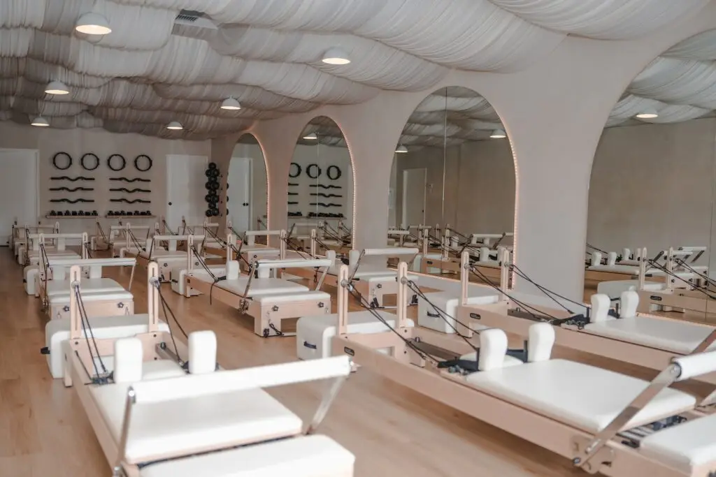
Best Pilates Studio for People With Tiny Roommates
Soul Pilates and Care
Pilates wasn’t just popular this year; it was practically a requirement for maintaining your San Diego residency. New studios seemed to appear weekly across San Diego, each promising stronger cores and better posture, but Soul Pilates and Care found a way to stand out by addressing a challenge many parents know well: finding time to exercise at all. Fitness doesn’t have to compete with parenting responsibilities. Parents can drop their kids off with trained caregivers while they head into reformer classes, eliminating one of the biggest barriers to working out. The studio has earned strong reviews for both its instruction and family-friendly approach.
The Hotel del Coronado’s sweeping $550 million restoration touched nearly every corner of the historic resort, but one of the most anticipated unveilils was the debut of its redesigned spa. The oceanfront wellness destination now features 21 treatment rooms, a relaxation lounge, a sauna, steam room, and a treatment menu inspired by the coastal environment just steps away. The redesign blends the Del’s Victorian legacy with a cleaner, more contemporary aesthetic, creating a space that feels distinctly SoCal rather than generic luxury hotel. For locals who don’t have time for a vacation, it’s the next best thing.
Best Cheers Without Beers
Good News Bar
As non-alcoholic beverages continue their meteoric rise, Good News Bar has become one of San Diego’s most compelling arguments for a booze-free evening. The University Heights hotspot serves a menu of carefully crafted zero-proof cocktails that borrow techniques and ingredients from traditional cocktail programs (it’s not just fancy juices and soda water), minus the hangover. The space also hosts regular community events and has quickly become a gathering place for everyone from sober San Diegans to the merely sober-curious. In a nightlife industry built around alcohol sales, Good News proved there’s plenty of demand for connection without the buzz.
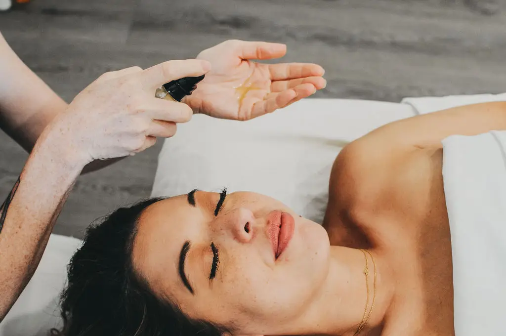
In Mexico for a wedding, a friend got a tourist-level sunburn. One of San Diego’s top restaurateurs—Arturo Kassel, founder of Catania and Gravity Heights—was on hand. He made a joke about how basic sunscreen literacy seems to be a male-pattern blindness.
“I said, ‘You know what? I’m going to start a men’s sunscreen brand, and I’m going to call it 4-Skin—because men are dicks and they need to cover up,’” he explains. “We spent the whole weekend thinking of puns and innuendos for this hypothetical brand we were never actually going to launch.”
The joke refused to die. Days later, one of the Mexico-wedding friends—a top marketer in the city—called Kassel and said the highly intentional dude humor might have a couple top notes of genius. So Kassel did a little digging into men and very basic skincare/sunscreen usage. Turns out, 1 in 29 are at risk of developing melanoma compared to 1 in 40 women.
“I was shocked to learn that only about one in 10 men actively use sunscreen, and that’s at the beach, on the golf course, or at the pool, when you’re going to get fried,” he says. “Daily use is essentially nonexistent.” During the process, Kassel became part of the story.
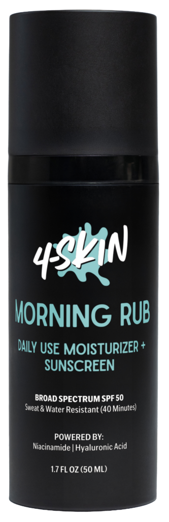
“My dermatologist called and told me I had basal cell carcinoma,” he says. “At that point, it went from being a business to a very personal mission. I became determined to move the needle when it comes to men’s apathy toward sunscreen.” And so—hundreds of hours later, including a still-going crash course on launching a CPG brand—a local restaurateur launched a jarringly named sunscreen and moisturizer for men. Broad spectrum, high-quality, SPF 50, lightweight, goes on clear, all the things. The daily-use morning routine version is called Morning Rub. Of course it is.
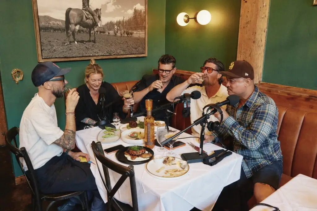
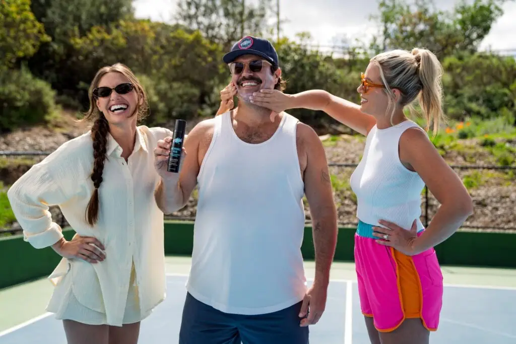
Kassel reached out to his friend Troy Johnson—San Diego Magazine co-owner and co-founder of Here We Are Studios,—to collaborate on creating two commercials for the brand. They launched July weekend. Friends went down to the beach to talk to strangers about their 4-Skin. Awkward, funny, and if all goes to plan: making men rethink their relationship to the blazing ouchie star in the sky.
“4-Skin is funny as a brand, but there’s nothing funny about skin cancer,” says Kassel. “That’s the one-two punch: we got your attention, maybe we made you laugh. And now we can tell you something that might extend your life.”
For this special-edition podcast from Here We Are Studios, Troy and Arturo sit down and tell the entire story of how a joke became a brand with a serious mission.
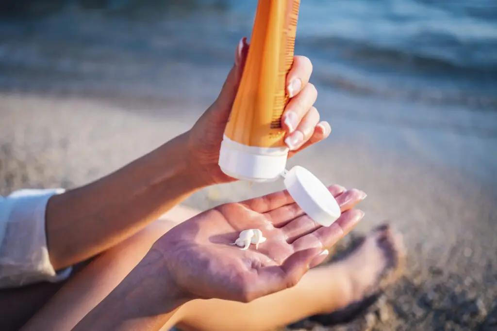
San Diego has always worshipped at the altar of good skin. Equal parts surf town, biotech hub, and wellness capital, it’s a city where lunch breaks become beach walks and sunscreen sits beside car keys by the front door. The products that get used here earn their place. With 266 sunny days a year and one of the highest rates of skin cancer in the country, we take skincare seriously. Dr. Bronner’s has been making soap in North County since the 1960s. Sun Bum was born in Encinitas and is now on shelves in over 70 countries. The tradition runs deep.
“Living in San Diego means your skin is exposed to sun almost every day of the year,” says Sue Zhang, M.D., a San Diego physician specializing in aesthetic medicine. “The products that tend to succeed here are the ones that can keep up with daily life, UV exposure, sweat, and movement, while still supporting long-term skin health.”
From a mineral powder that solves the sunscreen-over-makeup problem to an acorn oil serum rooted in Indigenous plant medicine, the local San Diego shelf is more diverse, and comprehensive, than most of us realize.
Courtesy of Kopari
Kopari
Sun Shield Body Glow SPF
A hydrating gel-oil hybrid that applies like a body treatment and leaves skin with a sheen that reads as healthy rather than oily. La Jolla–founded Kopari built its reputation on cold-pressed coconut oil sourced from family farms in the Philippines, and the Sun Shield Body Glow SPF is exactly that in summer form: coverage that doubles as skincare.
4-Skin
Morning Rub
The name is intentional. The founder got a basal cell carcinoma diagnosis that his dermatologist caught—she’s now his business partner. The question he couldn’t shake was why the skincare industry hadn’t yet figured out how to talk to men, and 4-Skin is the answer: a premium sunscreen and skincare line built around the kind of blunt, self-aware humor that gets guys to pay attention. Men’s skincare has needed this for a long time, and the formulas are serious enough to deliver.
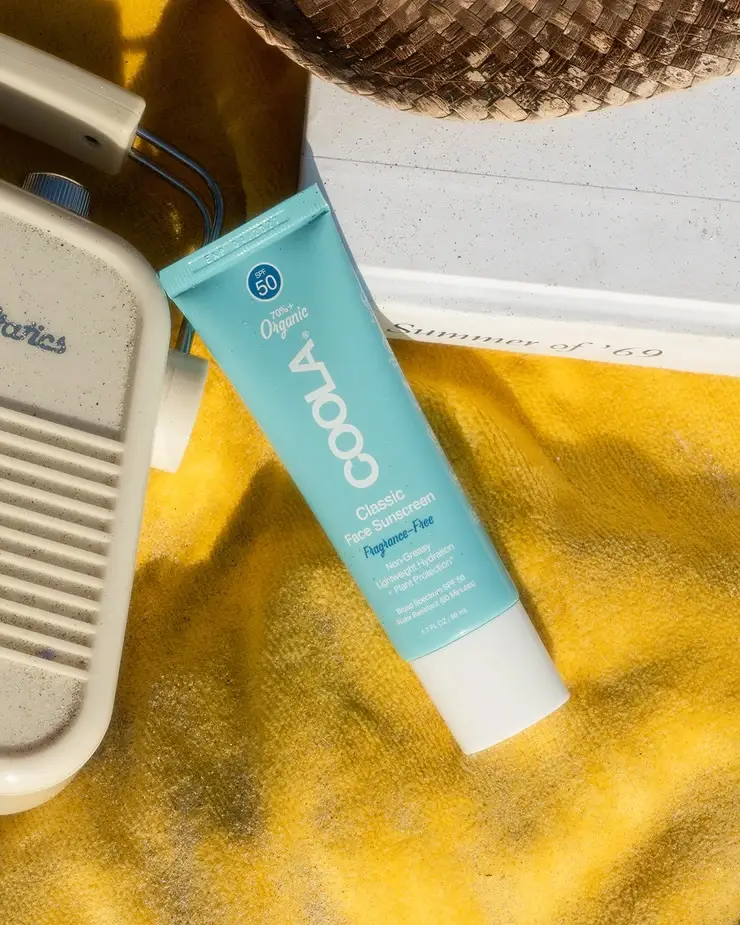
Courtesy of Coola
Coola
Classic Face Sunscreen SPF 50
Carlsbad-based Coola was formulating organic SPF before “clean sunscreen” was a marketing category, and the Classic Face Sunscreen is the brand’s thesis: protection that disappears into skin and layers cleanly under makeup. Sheer and lightly hydrating, it makes sunscreen easy to reapply before an afternoon walk at Torrey Pines.
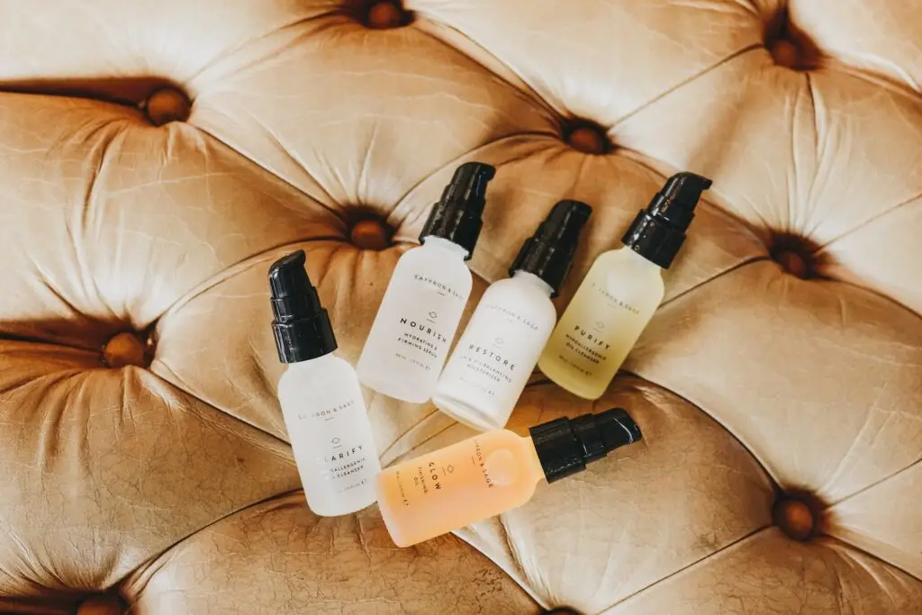
Saffron and Sage
Glow Finishing Oil
Squalane, argan, jojoba, and CoQ10: a short ingredient list that does a lot. The Glow Finishing Oil from Mission Hills wellness sanctuary Saffron and Sage is plant-based, scientifically grounded, and formulated to absorb rather than sit on the skin. The brand started as an integrative health practice where acupuncture, naturopathic care, and functional medicine share a roof, and the skincare line runs on the same philosophy.
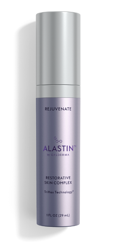
Courtesy of Alastin
Alastin
Restorative Skin Complex with TriHex+
The Restorative Skin Complex is powered by TriHex+, a patented peptide blend developed by Carlsbad-based Alastin’s team of SkinMedica veterans. It promises to clear out damaged collagen and elastin while supporting new production, the kind of gradual improvement that makes a product hard to quit.
Beldi is a multi-functional cleansing tradition rooted in Moroccan hammam culture, dating back over 12 centuries. Alia Jouj is the brand’s flagship product, and San Diego–based founder Dr. Mia Chae Reddy built a brand around it. Alia Jouj uses 100 percent organic, cold-pressed argan oil and the same ancient saponification method to produce a honey-thick liquid cleanser that softens skin without stripping it.
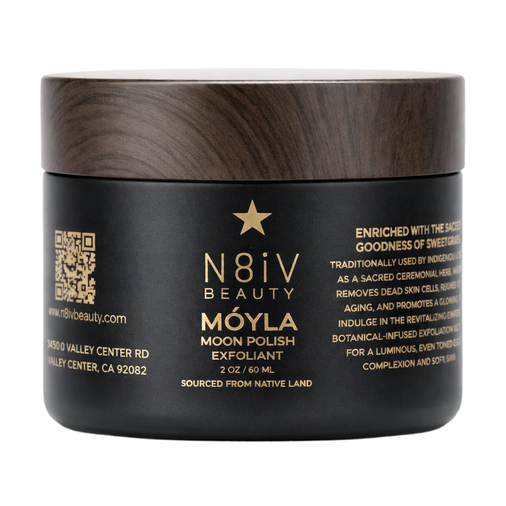
Courtesy of N8iV Beauty
N8iV Beauty
Móyla Moon Polish
Acorn oil has been used by California’s Indigenous communities as plant medicine for generations. Ruth-Ann Thorn, an enrolled member of the Rincon Band of Luiseño Indians, built N8iV around it as the first Native American–owned skincare brand to reach the national mainstream. The Móyla Moon Polish, named for the Luiseño word for moon, is an exfoliant centered on acorn oil Thorn gathers herself each year from the La Jolla reservation. Find it at the Gaslamp Quarter store Thorn owns at the historic Yuma Building.
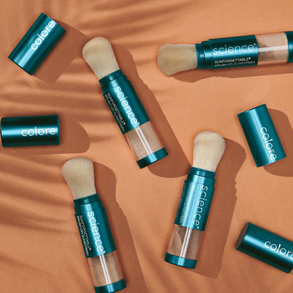
Courtesy of Colorescience
Colorescience
Sunforgettable Total Protection Brush-On Shield SPF 50
This product solved the reapplication problem. As a brush applicator, this mineral SPF goes over makeup without disturbing it, which is why it has been on derm-office retail shelves in Carlsbad and beyond for over two decades. The tinted version doubles as foundation.
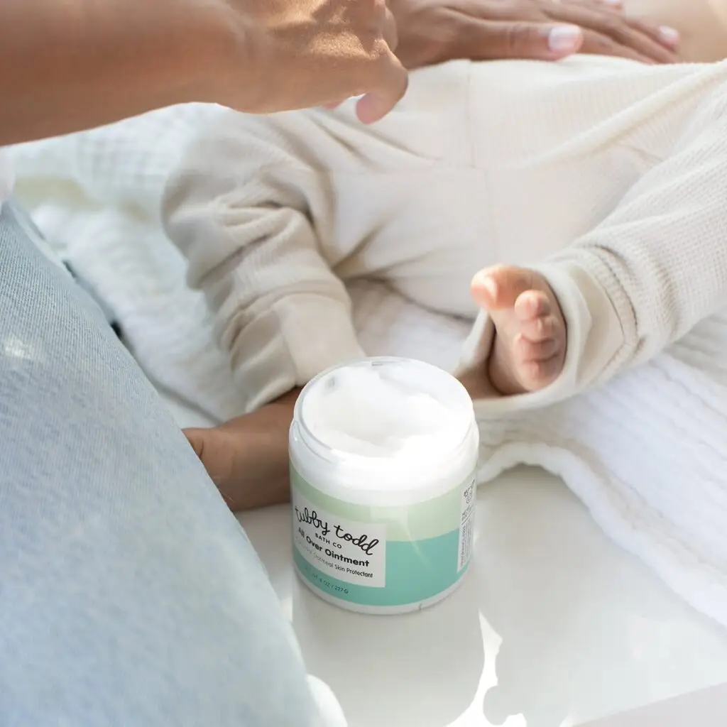
Courtesy of Tubby Todd
Tubby Todd
All Over Ointment
This steroid-free, petroleum-free eczema treatment was built specifically for babies and toddlers (although grown-ups can use it, too). It’s centered on FDA-approved 1 percent colloidal oatmeal with a base of sunflower seed oil, beeswax, and jojoba. The “linoleic-acid-rich sunflower oil is helpful for atopic, eczema-prone skin that is often deficient in that fatty acid,” says Dr. Zhang. Gentle enough for newborns, safe for daily use, and tested by both pediatricians and dermatologists.
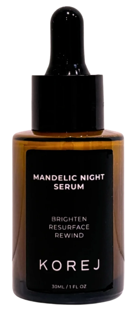
Korej
The Mandelic Night Serum
The Mandelic Night Serum pairs mandelic acid, an AHA derived from almonds and gentler than glycolic acid on sensitive skin, with lactic acid, niacinamide, and urea to brighten, smooth texture, and reduce breakouts overnight. Fragrance-free, vegan, cruelty-free. The brand name is the initials of the founder’s five daughters, pronounced like courage. Dr. Zhang also says she “really value[s] [the founder’s] mission to create pregnancy-safe skincare products that are both effective and wallet-friendly.”
Ingrid Yang, M.D., J.D. is a hospital-based physician in San Diego, CA, certified yoga therapist, and longevity specialist. She loves *double hearts* San Diego and spends her days helping people fully engage in long, healthy lives through evidence-based lifestyle medicine. Her books include Adaptive Yoga, Zen Mindfulness, and Hatha Yoga Asanas. When she’s not leading international wellness retreats, she is chasing sunsets, handstanding in nature, or geeking out over mitochondria.
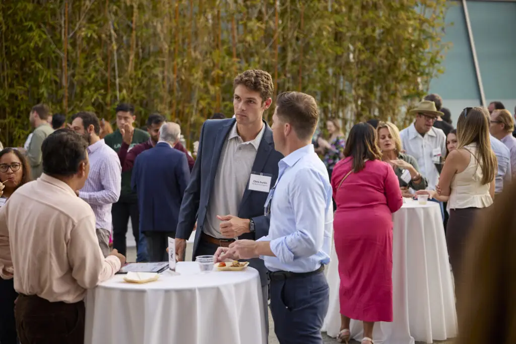
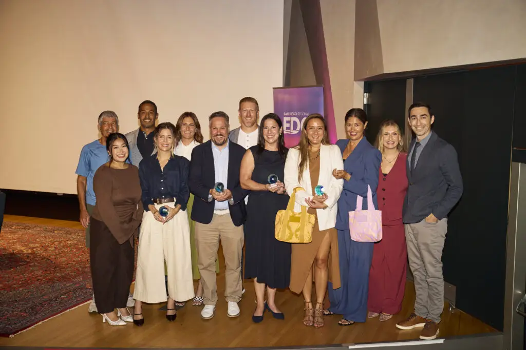
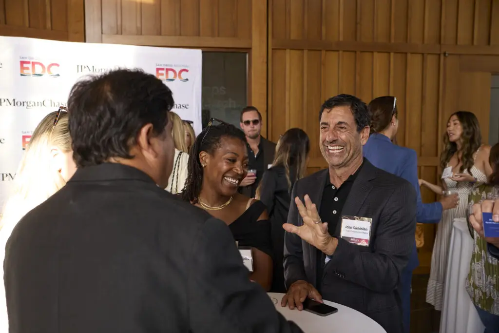
Renewable energy companies building hundreds of power plants. Biotech startups using artificial intelligence to create personalized medicine for children with rare diseases. Hospitality companies quietly powering thousands of local events. Consumer brands growing from beach-town startups into national businesses. These are the kinds of companies driving San Diego’s economy today, and the businesses recognized at this year’s San Diego Business Impact Awards offer a snapshot of where the region is headed.
Hosted July 23 by San Diego Regional Economic Development Corporation (EDC) and JPMorganChase, the second annual awards event honored four local companies for innovation, growth, and economic impact. More than 100 nominations from San Diego’s middle-market businesses were reviewed by a 10-person judging committee, with winners selected across four categories: startup, early-stage innovator, rising star, and established heavyweight.
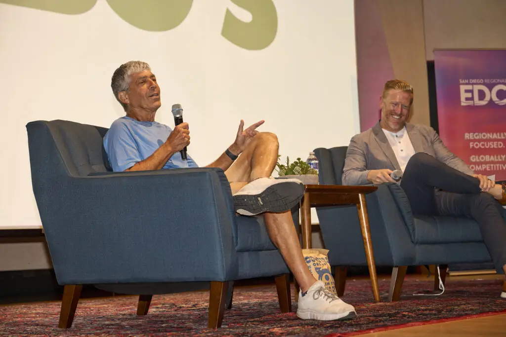
Two-time honoree Jimbo Someck, founder of Jimbo’s organic grocery stores, also joined the event for a fireside chat on buying local, supporting emerging brands, and giving back to the community.
“San Diego’s strength comes from its makers and builders—the resilient people who endure great risks and overcome obstacles to build and scale a company,” says Aaron Ryan, San Diego Region Manager and Middle Market Banking at JPMorganChase & Co. “These awards aren’t just recognition; they spotlight the talent, grit, and innovation shaping our region’s future. By celebrating those who create and build, we foster connections and fuel the growth that keeps San Diego thriving.”
Photo Credit: Matt Furman
Building the Infrastructure Behind Clean Energy
Heavyweight honoree SOLV Energy has grown alongside the country’s rapid investment in renewable power. “It’s an exciting time for SOLV Energy as we are experiencing significant growth,” says CEO George Hershman. “The business has doubled over the last year and has almost double-digit growth since its inception.”
The Rancho Bernardo-based company designs, builds, operates, and maintains utility-scale solar and energy storage facilities. Since its founding in 2008, SOLV Energy has built more than 500 power plants.
Growth has translated directly into hiring. About 200 employees work from the company’s local headquarters, including roughly 20 interns. “Our intern program is a big part of the way that we grow our workforce,” Hershman says. “Last year, 43 percent of our interns became full-time employees. We believe San Diego is a great community to build and grow a high-tech infrastructure and technology company because of the incredible workforce—the ability to attract top talent and draw from world-class universities.”
Photo Credit: Matt Furman
Developing Medicine One Patient at a Time
Startup honoree La Jolla Labs is tackling one of medicine’s biggest challenges by developing personalized RNA therapeutics for patients with rare diseases—many of them children with neurological disorders like ALS. Using proprietary artificial intelligence and machine learning tools, the biotech company develops treatments tailored to each patient’s specific genetic mutation.
CEO Tamar Grossman says the recognition reflects how far the company has come despite limited resources. “We’re honored to be recognized for our ability to change and save patients’ lives and turn our lean startup into a clinical company with very minimal resources,” she says.
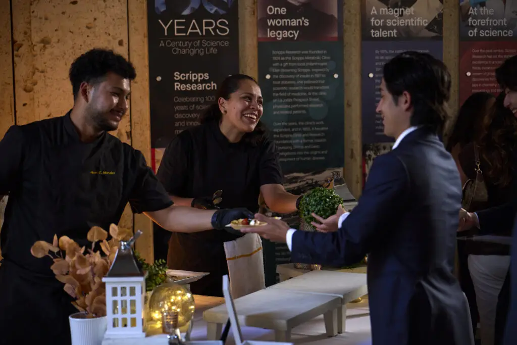
Grossman credits San Diego’s concentration of research institutions—including UC San Diego, the Salk Institute, and Scripps Research—with creating a pipeline of talent and collaboration. “San Diego is one of the world-leading centers for technology, genomics, and RNA therapeutics,” she says. “We have over 30 RNA therapeutics companies here, and we support each other and help with anything related to drug discovery.”
She says that collaborative spirit extends beyond formal partnerships. “You can walk around Torrey Pines, go into a café, and find colleagues from the industry and have an ad hoc conversation,” Grossman says. “That’s something very unique to San Diego.”
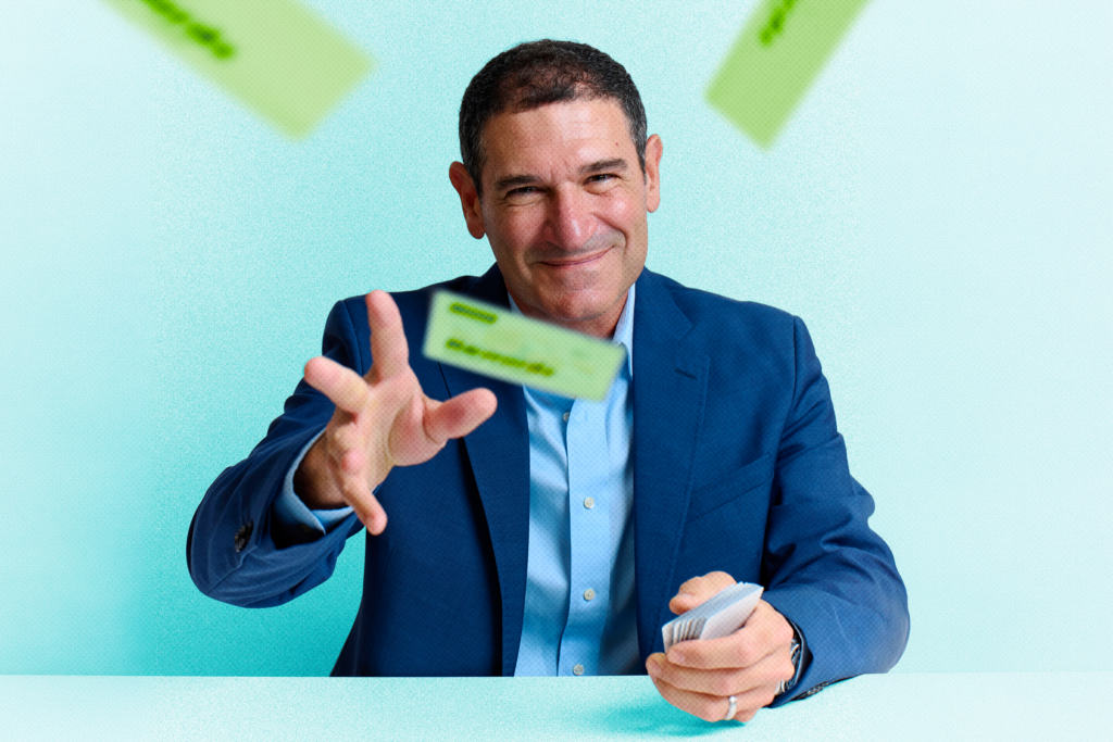
While Snake Oil Venue Company may not be a household name, chances are many San Diegans have attended one of its events. The early-stage innovator honoree has expanded from beverage catering and mixology consulting into venue management, operating Julep Venue in Mission Hills, Bramble Bay Venue in Imperial Beach, Vesper Venue, the Chapel at Liberty Station, and five outdoor venues throughout Liberty Station—more than 500,000 square feet of event space altogether.
“We do a lot of launch parties for corporations and new products,” says CEO Mike Esposito. “I really like working on the entrepreneur side of things, where new businesses are entering the San Diego market and looking to make a splash.”
Snake Oil has executed more than 16,000 events, employed more than 1,000 people, and partnered with more than 900 local vendors, including caterers, florists, photographers, entertainers, and other hospitality businesses. The company also works with many of San Diego’s nonprofits, museums, and cultural institutions. “We get to celebrate people’s most important moments,” Esposito says. “Whether that’s a wedding, celebration of life, or quinceañera, we’re fortunate to be involved in the community in so many different ways.”
Photo Credit: Matt Furman
Growing a Beach-Town Brand into a National Business
Rising star honoree ALOHA Collection is proof that a simple idea can grow into a thriving company. Founded by two roommates who wanted a better way to carry wet swimsuits after a day at the beach, the lifestyle brand has grown into a business while maintaining strong year-over-year growth.
Now headquartered in Carlsbad, ALOHA Collection employs more than 100 people and operates its California flagship store in Encinitas, which is slated for a remodel. With roots in Hawaii, the company is known for its lightweight, splash-proof travel bags that have become a familiar sight on beaches in San Diego and beyond.
“‘Aloha’ is part of our name, but it’s also how we move through the world,” says CEO Lynna Barnard. “It’s how we show up for people, the way we travel, the way we give back.” Since day one, the company has maintained a 5 percent giveback to Hawaii conservation efforts, contributing millions of dollars over the years.
“I think what’s so inspiring about ALOHA Collection, and the founders in particular, is when you dream big, those dreams can come true when you work hard and trust in the universe,” Barnard says. “It’s inspiring to be a role model for other people wanting to start businesses from humble beginnings. Start small and watch it grow.”
Together, businesses like these form a cornerstone of San Diego’s economy—not only through the jobs and revenue they generate—but through the local workers they hire, vendors they support, and investments they make in the region. Their growth doesn’t happen in isolation; it ripples outward, strengthening the broader business community and the people who call San Diego home.
Rub some dirt on it. Walk it off. Be a man. The tropes and reasons for men ignoring their health and doing preventive care are many, reinforced by action heroes and generational norms. As a result, compared to American women, American men live an average of five years less, seek healthcare treatment half as often, and die by suicide nearly four times more often.
Many national campaigns have tried to change this. This year’s “Relax Your Tight End” ad from Novartis during the Super Bowl—in which NFL legends advocated for early prostate cancer screenings—was a high-profile example. Meanwhile, in San Diego, Evan Miller seems to have figured it out.
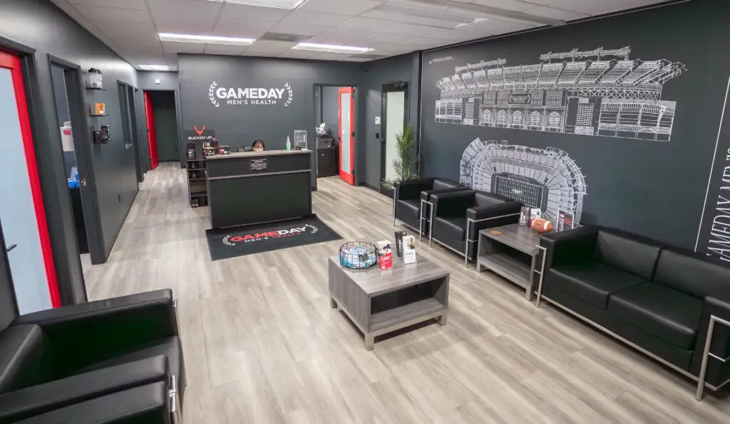
Miller founded Gameday Men’s Health in 2018 as a small clinic in Carlsbad. The idea was to create a space men would actually want to spend time in. So he built Gameday to feel more like a sports bar or a man cave—snacks, sports on oversized, high-def flat screens in the waiting room. He personalized the care for each client, made the experience more casual, and, above all, efficient. If the wait for payoff is too long, Miller says, men won’t show up for their health.
“We need to feel better quick,” he says. “So that’s where the real hook with Gameday is: It’s fast; it works quick.”
The idea has worked. Big time.
Gameday now has 430 locations spread across 46 US states and parts of Canada, with hundreds more set to open over the next three years.
Prior to Gameday, Miller—who has a Ph.D. in clinical psychology—ran Akua Mind Body, an addiction treatment center in Newport Beach. After selling the center, Miller says he searched for a new way to help his community.
He drew from his behavioral health training and dispiriting past experiences with “sketchy” men’s clinics, albeit with a slightly different concept at first.
Courtesy of Gameday Men’s Health
“My original idea for Gameday, funny enough, was men’s group therapy,” Miller says. “I wanted to put it in this ‘man cave’ environment because I knew guys wouldn’t show up otherwise.”
Initially envisioned as safe spaces to encourage men to open up emotionally, Miller pivoted to a more clinical approach with an athletic design that personally appealed to him. Soon, it evolved into a one-stop shop of compounded medication treatments for weight loss plans, hair loss treatments, anti-aging injections, sexual wellness strategies, and testosterone replacement therapy. The hotly debated trend of peptides—mini amino acid proteins that the FDA has yet to approve—has become a popular feature.
New patients undergo in-clinic assessments for testosterone and prostate levels with the goal of producing test results in just a quarter of an hour. “Our philosophy with our treatments is we only do what the research supports,” Miller says.
An Orange County native, Miller found Carlsbad to be a natural headquarters. He found a much bigger market in coastal North County of men seeking a boost—both in their marriages and their overall livelihoods. The pandemic proved to be a watershed moment, with front-yard gyms and outdoor, highly visible exercise sparking a wave of self-care. According to Cleveland Clinic, after the pandemic, about 20 percent of men started to exercise more and eat healthier, with a quarter of men reporting they scheduled more sleep and spent more time with family.
“When Covid happened, [suddenly] everyone looked in the mirror and was like, ‘I need to take care of my health; I have to do everything possible to get in shape,’” Miller says.
Two years after Gameday first began, Miller opened a second clinic in Temecula, followed by locations in Laguna Beach and Newport. Demand kept coming, so they started franchising in 2023. They sold 1,000 licenses in the first year. By 2025, they had over 400 clinics across the country.
When asked about the rapid growth, Miller cites the feedback he received along the way: “People were so excited about men’s health, cash-pay medicine, and not having to wait for insurance. They understood the model. It was for guys; it felt like ESPN meets healthcare.”
Now Miller says Gameday is starting to map out a global expansion—to Europe, Latin America, and the Middle East. Since the company first cultivated a following, Miller says there have been persistent questions about whether Gameday would ever expand its focus to include women. Their answer: Her Way.
“We only offer a very narrow menu, almost like In-N-Out Burger, because we stay in our lane, we do it really, really well, and we gain trust that way,” Miller says. “So we created the Her Way model to do the same thing for women [that] we’ve done with men.”
Her Way Health & Hormones launched in 2024 in clinics with more neutral and calming décor. With locations in Carlsbad and Mission Valley, it will officially start franchising this summer. Miller seems incapable of thinking small and expects around 1,000 Her Way locations to open nationwide within a few years.
Ryan Hardison is a freelance arts and entertainment writer and recent graduate of San Diego State. When he's not staring at his laptop, he's likely eating an adobada burrito or getting sunburnt at the beach.
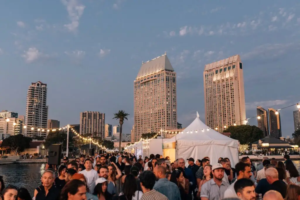
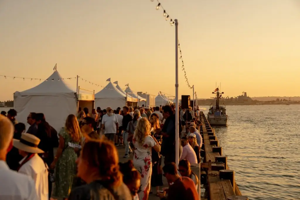
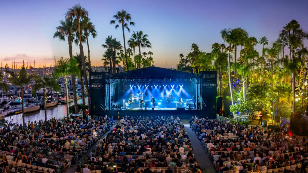
Summertime in San Diego may bring about blue skies and sun-drenched days, but it doesn’t stop there. There’s also the top-notch concerts, tasting events and wallet-friendly fixtures that make this season feel extra special. Fans of contemporary and classical music can check out performances by the San Diego Symphony Orchestra, the Beach Boys and Kool & The Gang at The Rady Shell or the annual Mainly Mozart All-Star Orchestra Festival in La Jolla. Local gourmands can sign up for a spot at our Omakase Open, indulge in cold desserts at Scoop San Diego or journey across a two-mile stretch of good eats during the Taste of Adams Avenue. As for free events, there’s a new edition of San Diego Made: LIVE at San Diego Made Factory, the Pride Party at Museum of Us and the return of the Ocean Beach Street Fair & Chili Cook-Off.
Japanese omakase dining is an artform built on trust, in patrons allowing their chef to entirely curate their meal. That’s why, this Thursday from 6-9 p.m., San Diego Magazine is gathering the city’s finest sushi and omakase chefs to showcase their skills during the21-plus Omakase Open at JULEP. Guests can enjoy live music, all you can eat food and drink, plus the chance to converse with local culinary masterminds and decide on the night’s best bites, all while supporting the Convoy Pan Asian Cultural and Businesses Innovation District. General admission ($85) is full up, but join the waitlist in case more tickets become available.
1735 Hancock Street, Mission Hills
Taste of Adams Avenue
June 28
From University Heights to Kensington and the unique neighborhoods in between, Adams Avenue is home to a host of must-try flavors. During the 25th annual Taste of Adams Avenue, happening this Sunday from 11 a.m. to 3 p.m., 45 spots along Adams Avenue will offer samples, with brunch-inspired bites, refreshing ales, world-class gelato on the menu. Attendees can make the most of their self-guided tasting tours by walking, biking or riding from end-to-end on a complimentary trolley. Tickets are $55 online and $65 the day of.
Adams Avenue
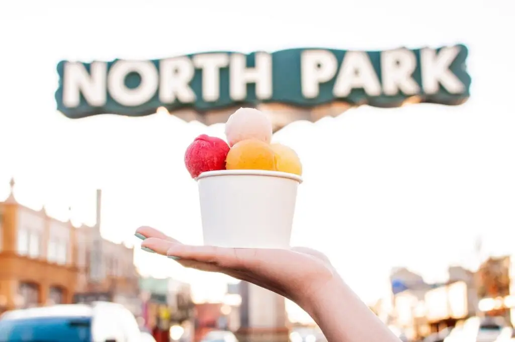
Scoop San Diego Ice Cream Festival
June 28
It’s a scientific fact (source: trust me) that a little sweet treat, like say ice cream, paletas or shaved ice, has the power to make any day instantly better. Meaning, it’s only right to treat yourself to a dessert-filled afternoon during the 8th annual Scoop San Diego Ice Cream Festival, where three dozen local vendors will serve up their finest specialties this Sunday from noon to 4 p.m. in North Park. General admission ($49) comes with 10 shareable two-ounce samples; all net proceeds will go towards Feeding San Diego.
30th Street & North Park Way, North Park
Concerts & Festivals in San Diego This Weekend
Mainly Mozart All-Star Orchestra Festival
Through June 27
Week two of the 38th Annual Mainly Mozart All-Star Orchestra Festival begins Tuesday (7 p.m.) with a performance of Mozart’s “Jenamy” and pieces by Lully and Strauss, followed by Mozart’s “Jupiter,” and works by with Schumann and Pärt on Thursday (7 p.m.), both at The Conrad; tickets range from $71 to $163 for each concert. The festival will then conclude Saturday (7 p.m.) with Mozart, Brahms and a performance of Beethoven’s Symphony No. 5 at Epstein Family Amphitheater; tickets range from $26 to $263. And if that’s not enough Mozart for you, pianist Anton Nel will lead a prelude concert in the JAI prior to Tuesday and Thursday’s shows.
The Conrad: 7600 Fay Avenue, La Jolla | Epstein Family Amphitheater: 9500 Gilman Drive, La Jolla
Opening Weekend at The Rady Shell
June 26–28
A star-studded opening weekend is in store to kick off The Rady Shell’s summer season. On Friday (7:30 p.m.), Rafael Payare will conduct the San Diego Symphony Orchestra in an effusive Opening Night program featuring violin soloist Stefan Jackiw; tickets range from $57 to $124. The following night at 7:30 p.m., the orchestra will pair up with The Beach Boys, plus special guest John Stamos, for a rousing tribute to Pet Sounds; tickets range from $78 to $268. Then, on Sunday (7:30 p.m.), audiences can boogie their way to Monday with Kool & the Gang and hip-hop pioneers the Sugarhill Gang; tickets range from $68 to $152.
Ryan Hardison is a freelance arts and entertainment writer and recent graduate of San Diego State. When he's not staring at his laptop, he's likely eating an adobada burrito or getting sunburnt at the beach.
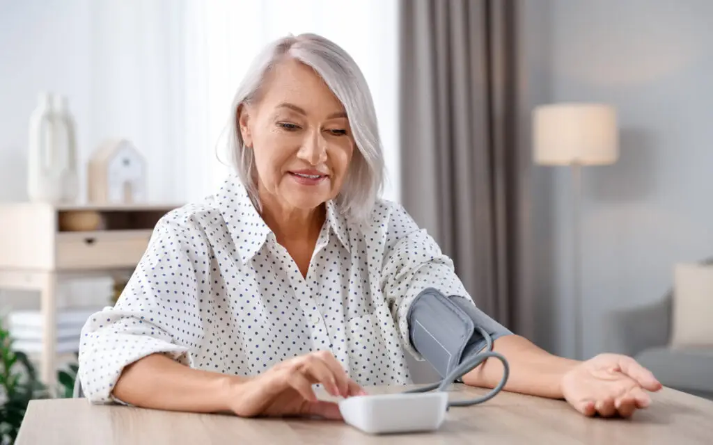
It’s estimated that 44% of women in the U.S. have high blood pressure, also known as hypertension, but many don’t know it. The disease often has no symptoms, and when symptoms do present, they can appear similar to many other conditions. High blood pressure increases the risk for heart disease and stroke, so it’s critical that it’s detected and treated early. And for women at risk of developing high blood pressure, prevention is key. Click here for the basics of high blood pressure and how Scripps physicians at Scripps use screenings not just as a diagnostic tool, but as part of routine preventive care.
For more nutrition, wellness, and healthy living tips, sign up for the San Diego Health newsletter here.