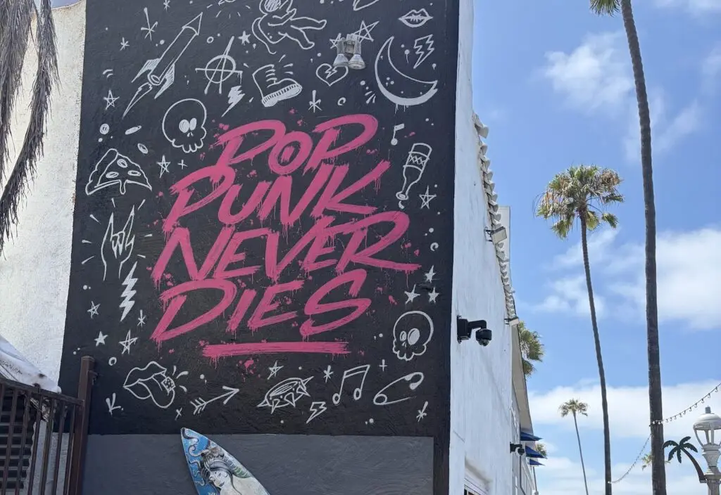
Before bottleneck traffic and the modern housing crisis, San Diego was a swath of undeveloped land, horse-drawn carriages, and dairy farms. We look at 10 iconic locations from the late 1800s to mid-1900s that show just how much (and in some cases how little) our city has changed over the years.
Photos Courtesy of the San Diego History Center
Vintage San Diego: How Our City Has Changed Since 1876
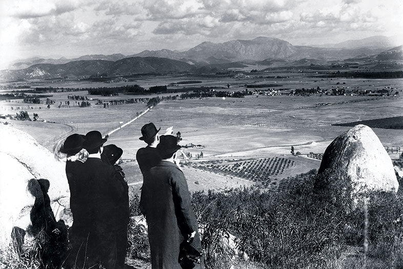
An unidentified group looks toward El Cajon. The two gentlemen on the right could likely be business partners Ed Fletcher and William Gross, showing their development-ready land to potential buyers. Pennsylvania-born Gross was a theater agent and actor interested in establishing an artists’ colony, which was in fashion at the turn of the last century (for a time, composers and touring performers kept homes in the La Mesa area). Gross made no secret of his admiration for Fletcher’s sister Bess, and, perhaps as a gesture of appreciation, it was she who suggested the name “Grossmont.”
Vintage San Diego: How Our City Has Changed Since 1876
1876
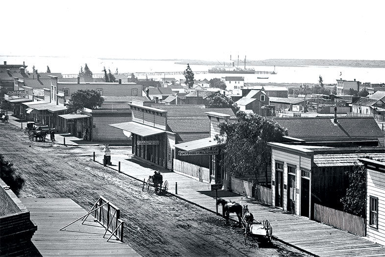
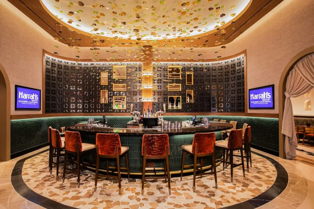
Gaslamp Quarter
Fifth Avenue and Broadway
With the country still in Reconstruction after the Civil War, San Diego’s elite were desperately lobbying for a transcontinental railroad to run south of the Rockies and bring investors, developers, and commerce, which would ultimately raise property values. In 1871, businessman E. W. Morse wrote, “We are suffering another drouth this year, but if the railroad bill passes we can stand it, but if that fails God help us.”
Several obstacles got in the way, namely competition from the Central Pacific route, too few land grants, and an overall bust-and-boom financial climate. San Diegans never got their railroad, and they would have to wait another forty-two years for the Panama Canal to open, making San Diego the first port of call on the U.S. West Coast.
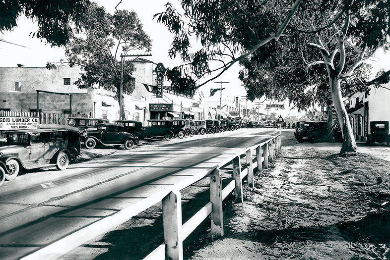
Vintage San Diego: How Our City Has Changed Since 1876
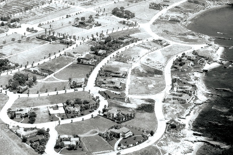
1929
Encinitas
Highway 101
La Paloma Theatre, which opened 12 months before this photo was taken and still stands today, welcomes patrons with its grand marquee. Though talkies debuted the same year as La Paloma, the theater’s owner installed a pipe organ for all the silent movies still being produced. (Notice that the sign reads, “News. Comedy Laurel Hardy.”) In those days, Highway 101 was the only road to Los Angeles, as I-5 would not be completed in its entirety until 1979.
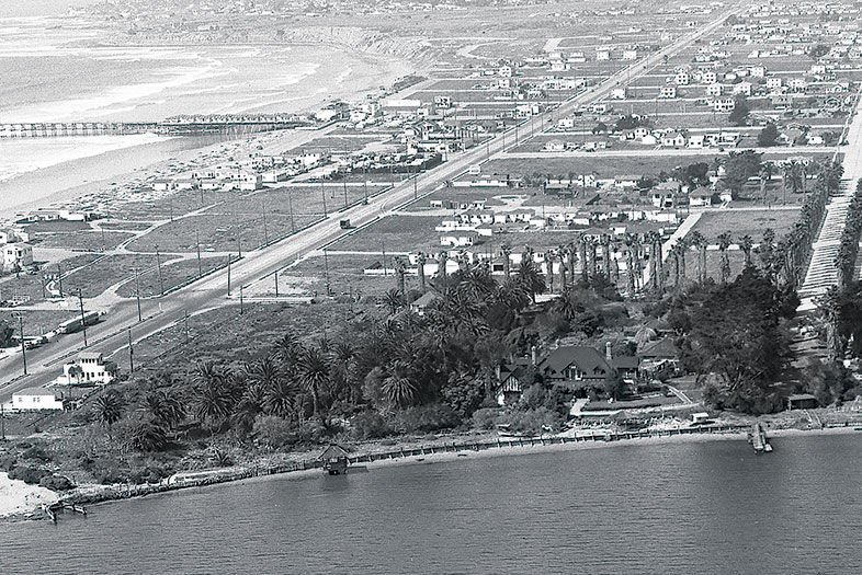
Vintage San Diego: How Our City Has Changed Since 1876
1945
Sail Bay and Pacific Beach
The site of the Catamaran Resort Hotel and Spa was once home to Emma Jessop and Frederick Tudor Scripps. He was the brother of newspaper magnate E. W. Scripps and the half brother of Ellen Browning Scripps. Look closely at the pointed, Tudor-style roof among the fruit orchards at the bottom of the photo—this was the home’s formal dining room. When the hotel came along, this section of the house was transformed into the Catamaran Wedding Chapel.
Decades later, hotel expansion would force it out, but preservationists saved the structure and eventually relocated it to the base of Mount Soledad. If it looks familiar, that’s because it’s now the wedding chapel known as Rose Creek Cottage on Garnet Avenue.
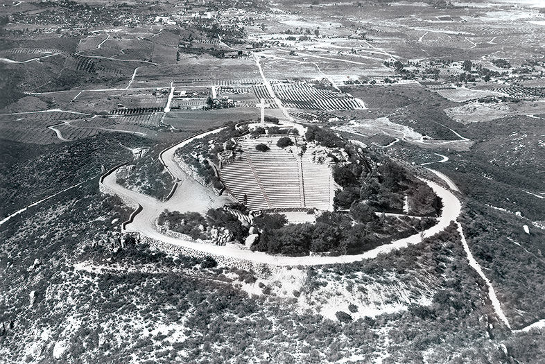
Vintage San Diego: How Our City Has Changed Since 1876
In 1924, Ed Fletcher gifted the six-acre cap of Mount Helix to a local family so they could build a memorial to their mother. The family received help from prominent San Diego architect Richard Requa, pioneer of the Southern California style, also known as Spanish Revival. This photo was taken after 1933, when the State Relief Administration (renamed the Civil Works Administration in 1934) hand-fitted the stone walls encompassing the Mount Helix Nature Theater and most of Mount Helix Drive. Now a county park, it is maintained by its trustee, Mt. Helix Park Foundation.
Vintage San Diego: How Our City Has Changed Since 1876
1938
La Jolla
In the Lower Hermosa neighborhood south of Windansea Beach and north of Bird Rock, the road closest to the shore is Camino de la Costa. The house at the bottom right was brand new when this photo was taken, and is now listed on Redfin for $18 million. In 1938, the average cost of a home in the U.S. was $3,900, or about two times the average annual income. The straight, darker road running diagonally through the top of the photo is La Jolla Boulevard.
Note the large white lot to the east of it. The building is the San Carlos Electric Railroad Station, built in 1924 for the San Diego Electric Railway (the streetcar line), which ran until 1949. In 1953, the structure was purchased by the members of La Jolla United Methodist Church, which still operates there today. Later, they bought two buildings next door, La Plaza Mexican Restaurant and El Toro bar. According to the La Jolla Light, the first margarita in the U.S. was served in 1947 at La Plaza.
Vintage San Diego: How Our City Has Changed Since 1876
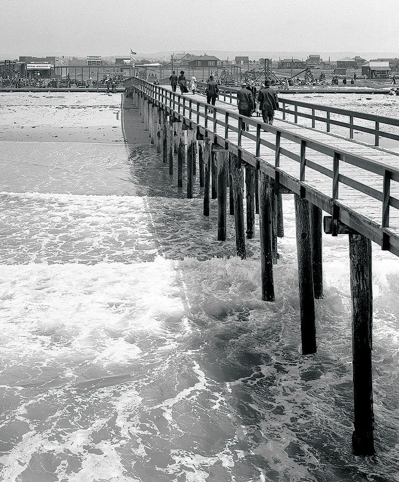
c. 1910
Imperial Beach Pier
Imperial Beach got its name from developers attempting to entice those in the Imperial Valley to summer in this coastal area. At the time this photo was taken, the town had just laid down its first sidewalks and installed the pier, which was built in order to generate electricity for the town—machinery at the end of the pier harnessed the energy of the waves. But it didn’t work as well as planned, and was later dismantled.
Vintage San Diego: How Our City Has Changed Since 1876
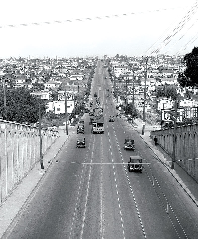
1930
Hillcrest and North Park
Georgia Street Overpass
From the Georgia Street Bridge looking east on University Avenue, notice the streetcar passing Florida Street. Today a person can still enjoy a view from the bridge, which is undergoing a $14-million makeover to render it earthquake friendly. Scheduled to be completed next summer, the 102-year-old bridge, which was put on the National Register of Historic Places in 1998, will reinstate certain features, such as vintage-style lampposts.
Vintage San Diego: How Our City Has Changed Since 1876
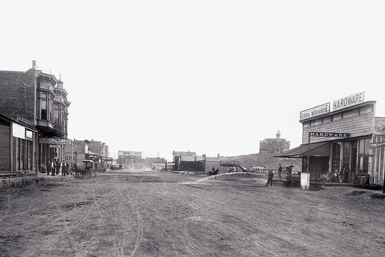
1889
Escondido
Grand Avenue
Once known as Rincon del Diablo, this area became Wolfskill Plains and then, officially, Escondido in 1884. The city was incorporated one year before this photo was taken. On what is still a main artery today, hardware stores, land agents, and a new 100-room hotel lined the wide avenue creased with wagon tracks. An extension of the Santa Fe railway was also a welcome addition. The same year, a San Diego tavern owner named Wyatt Earp helped judge a county fair horse race just north of town.
Vintage San Diego: How Our City Has Changed Since 1876
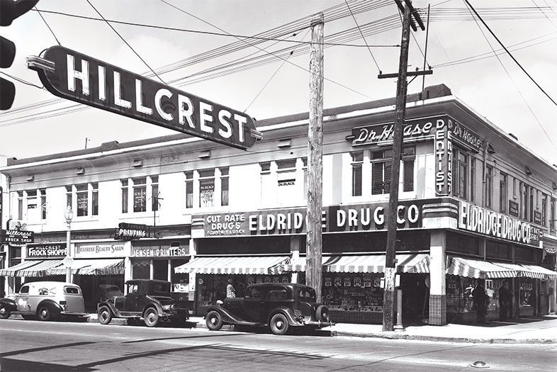
c. 1930
Hillcrest
University and Fifth Avenue
This community grew as downtown San Diego spread north in the late 1800s, calling for houses, apartments, and eventually retail—with extensive signage. Dentists don’t usually get neon signs, but as this photo shows, Dr. Haase did—as well as Eldridge Drug Co., offering “cut rate drugs” and a “fountain lunch.” Today on this corner you’ll find Vietnamese food, a tattoo parlor, vape lounge, and, where Eldridge stood, Perlman Clinic.
Everything SD
JULY 15, 2026
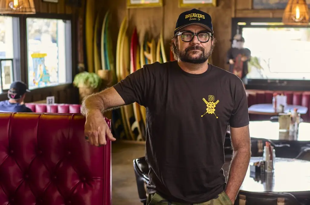
He Saved an Encinitas Landmark Then Built a New One
After Captain Keno's closed, pro surfer Benji Weatherley gave its tables, dishes, and memories a second life at Breakers Cafe Bar & Grill
Captain Keno’s No. 8 special—pancakes, sausage, toast, home fries, and eggs for $2.99—was the fuel that powered Benji Weatherley for surf competitions as a teenage pro. A couple decades later, tears were shed when the Coast Highway dive-slash-eatery called it a day after 54 years. Usually, the guts of a shuttered restaurant go to liquidation auctions or straight to the dump to decompose along with its legend. Instead, Weatherley took in Keno’s spare parts—plus other relics from Encinitas’ past—and used them to build the newest community hangout.
Every single piece in the place is from somewhere in this town,” Weatherley says about Breakers Cafe Bar & Grill. “I’m not going to settle for anything less.”
Breakers is a Hawaiian hideout in an uncool part of the coastal surf town, but it’s got the set design of an Encinitas superfan. The plates, silverware, and coffee mugs are from Keno’s. So are the tables and booths. There’s a bench made from the last table preserved in The Derby House (a building that, for over a century, was a hotel, then became a hospital, a religious retreat, and a private home). Weatherley’s not performing CPR on old upholstery because he’s a fan of antique furniture. It’s a method to bring people together.
“Representing nostalgia in this town is the only way to grasp a hold of the community,” Weatherley says. “Everyone wants to touch and feel something different from what they’re experiencing on their phones.”
Photo Credit: Matt Furman
Every week, locals bring him photos, artifacts, and bits of paraphernalia from Encinitas’ past and ask Weatherley to give them a new home. “I’ve had ladies who were there when [Captain Keno’s] opened cry in my arms and say, ‘This table is where I had my second birthday with my grandma,’” he says. “They tell me these stories, and I tell them I have all the same stories about my mom.” (Weatherley’s mom first brought him to Keno’s and helped raise the young surfers from the Momentum Generation documentary—Weatherley, Taylor Steele, Rob Machado, Kelly Slater, etc.—as they surfed some of the world’s most dangerous waves at Pipeline in Hawaii. Back then, she owned Breakers Restaurant & Bar in Haleiwa. Name sound familiar?)
Weatherley has always been the funniest man in the room. He calls Breakers “the Chuck E. Cheese of Encinitas.” The restaurant hosts hula dancing classes, open-mic comedy nights, and evenings bartended by longtime Captain Keno’s barkeep Vaka Kaufusi. Cult-loved reggae band Steel Pulse hit the Breakers stage recently to perform a new song that Weatherley also helped write. His longtime friend Jack Johnson has dropped by to sing a few, too.
Despite not having a fancy location along the 101, people are catching on. Fire stations and hospitals have held staff parties there. Weatherley also currently sponsors four sports teams.
“Last night, I had a girl say, ‘I want my birthday party at Breakers,’” he says. “That, to me, is community in a nutshell.”
Emma Veidt is an editor at San Diego Magazine. She earned her bachelor's and master's degrees from the Missouri School of Journalism. She loves running, hiking, and rock climbing, but really, she mostly loves encounters with the street cats around North Park.
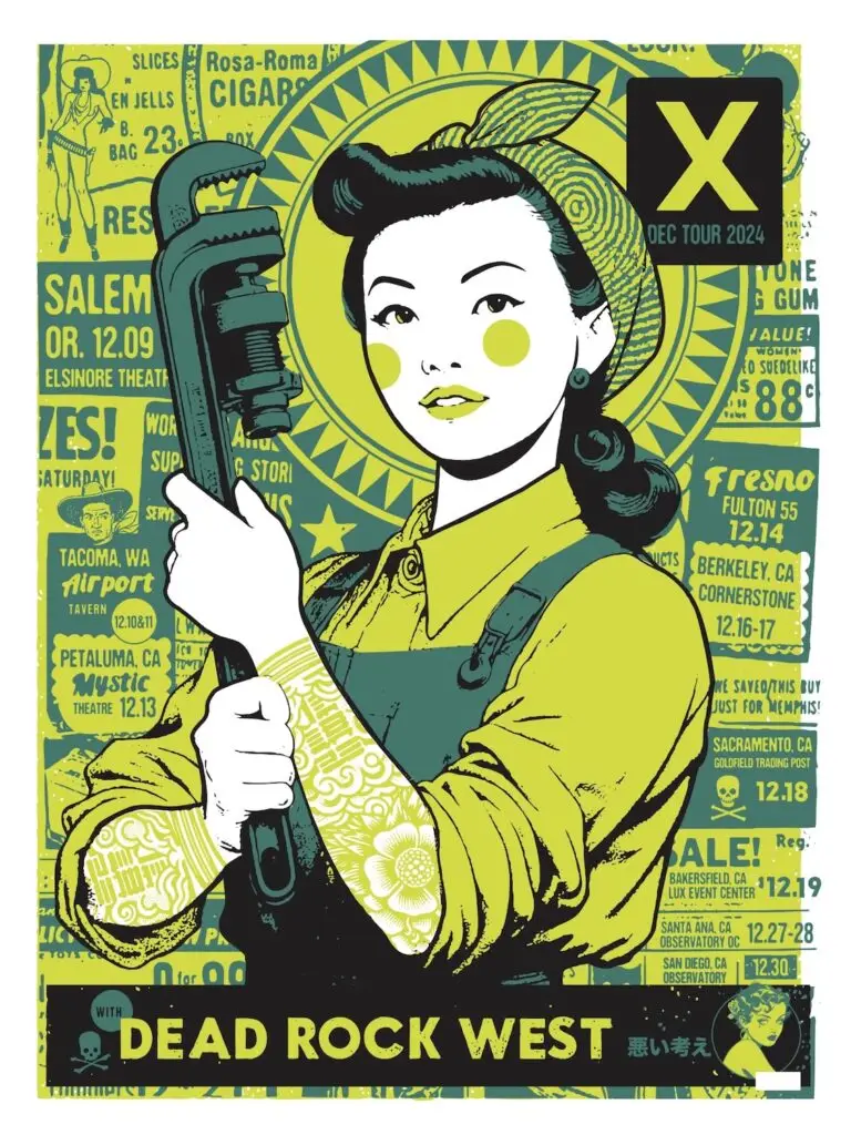
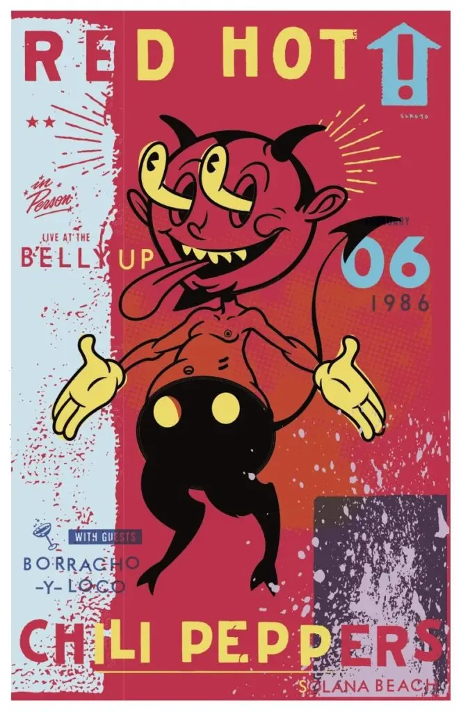
How Scrojo Became One of Rock’s Most Prolific Poster Artists
The San Diego designer has created more than 3,000 concert posters over nearly 40 years for artists including the Rolling Stones and the Red Hot Chili Peppers
When he was in high school, he and his friends were trying to come up with the perfect name for their punk band that would encapsulate all their personas. Nicaragua. The Freds.
One of his friends said he was going to go by Jimmy Stacks and called it “the perfect rock and roll name.” Their names changed so much that Haskett erupted: “Fine, I’m f—ing Scrotum Joe, the true defender of the Open West.”
Their response: Wow, that’s a great name.
As a teenager, he drew chalkboards for Del Mar’s Pannikin coffee shop and would design T-shirts for surf/skate brand Life’s a Beach. He signed the shirts with his moniker, but even in punk rebellion, who wants a shirt with the words Scrotum Joe on it? “They just cut out the ‘t-u-m,’ and the next thing you know, a client referred to me as that, and it stuck,” he says.
Courtesy of Scrojo
Scrojo could have been part of a band as iconic as The Misfits—had he been able to learn the famously cumbersome bassline to The Kingsmen’s “Louie Louie.” Becoming one of the most renowned concert poster designers—someone who quite literally designed the cover of Art of Modern Rock: The Poster Explosion—is a pretty good Plan B.
“To my knowledge, he’s done more rock posters than anybody else alive,” says Dennis King, whose D. King Gallery in Berkeley, California, serves as one of the largest private rock poster collections in the world. “He’s the hardest-working guy in the poster business.”
King not only co-authored the sequel to music historian Paul Grushkin’s The Art of Rock, but he also handles distribution and sales for all of Scrojo’s work. That’s more than 3,000 different posters over nearly 40 years. (That’s over one poster each week. For four decades straight.)
For anything from boxing matches to rodeos, posters have long been used as promotional items. Toulouse-Lautrec’s famous lithographs advertised Moulin Rouge in the late 1800s. Around the same time, Hatch Show Print in Nashville was making handbills for the Grand Ole Opry.
“I propose this: Cave paintings are the first poster art,” Scrojo says.
Courtesy of Scrojo
Rock and roll posters took off in the 1960s, when the hippie counterculture era replaced conformity and suburbia. Artists like Jimi Hendrix and the Grateful Dead used their vibrant, psychedelic prints as a form of rebellion from the mainstream. Posters were promotional, commemorative, collectible, and especially expressive.
If the name Scrojo is any indication, he doesn’t shy away from imagery that toes the line of being too provocative. He focused more on what inspired him instead of trying to be offensive for the sake of getting attention.
“Didn’t want to show it to my grandmother, but my parents were fine with it,” Scrojo says with a laugh.
“We’ve had to ask him to put a Band-Aid over a nipple every now and then,” says Chris Goldsmith, president of Belly Up Tavern in Solana Beach, where Scrojo started out and hundreds of his posters currently line the walls.
Scrojo spent six weeks at Otis College of Art and Design for a summer semester before drugs, alcohol, and a self-described lack of discipline prevented him from enrolling full time. Still, he taught himself concepts like text hierarchy and later found his niche at the Belly Up and in the surfing and skating world, working with brands like Quiksilver, Rip Curl, Scorpion Bay, and DGK.
His first concert poster was for North County band Borracho y Loco, of which Goldsmith was bass guitarist. Scrojo drew an abstract version of the Belly Up’s iconic shark with colorful calypso and tiki themes.
Early on, he would craft using a pencil, pen, non-reproduction blue pencil, X-Acto knife, rubber knife, and proportion scale to create each poster, and the finished product could take a week or even longer.
Courtesy of Scrojo
“I recommend every artist coming up to do that for like six weeks,” Scrojo says. “It forces you to think about every design decision as you’re going along.”
He has since mastered vector imagery through Adobe Illustrator to the point where, depending on the level of detail needed, he could finish two projects in a day. Still, he fills sketchbook after sketchbook to blueprint.
“I liked his line in particular, and he knows how to draw, which a lot of people don’t really know how to do these days,” King says.
Scrojo would research what each musician’s merchandise looks like to get a feel for each artist’s tone and voice. Once he has his central image in mind, he focuses on what and where to place the text.
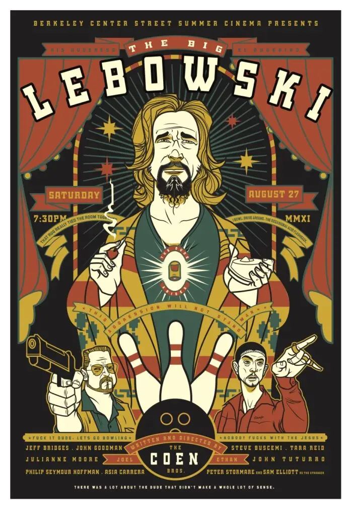
He doesn’t have one specific style, ranging his talents from art deco to psychedelic and everything in between (and outside the lines). Want a pop surrealist comic book cartoon devil with splattered paint textures, halftone dot patterns, and pure chaos? Red Hot Chili Peppers, February 1986. Want a minimalist graphic portrait with bold strokes and graffiti text? P!nk, October 2023. Want a carnival sideshow style piece with a tasteful caricature of Jeff Bridges? The Big Lebowski, August 2011.
Scrojo calls himself a jack of all trades because he can create posters for all music genres. King calls him a chameleon for his ability to adapt his voice to new eras.
Courtesy of Scrojo
“The variety of his skillset makes it possible for us to put 50 of his posters on a wall next to each other and have it look compelling, not just a bunch of the same thing over and over,” Goldsmith says.
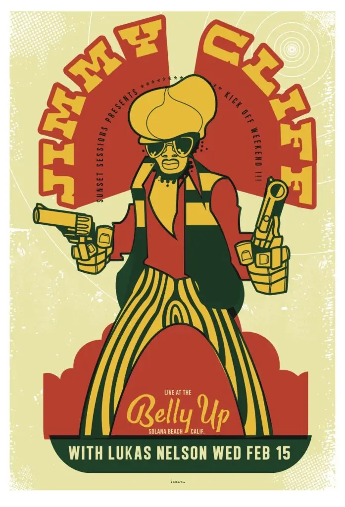
Some of Scrojo’s favorite posters are when he feels a personal connection to the artist or the album. He has a vivid memory as a child of being trapped in a closet filled with marijuana leaves while playing hide and seek and staring at Jimmy Cliff’s “The Harder They Come” LP. “For whatever reason, as a kid, that sparked a desire to do graphic design,” Scrojo says.
Fast forward to February 2012, Cliff is performing at Belly Up. Scrojo decided to modify Cliff’s original album cover from rainbow gradient fills to classic reggae psychedelia while preserving Cliff’s striped pants and bold hat. Cliff’s manager called him and said they wanted to use it for the rest of their tour.
“We always get artists requesting that he does their posters,” Goldsmith says. “A lot of artists don’t want venues to go all rogue because they want to control how they’re being presented. With him, they’re like, ‘Let him go nuts.’”
Matt Eisenberg is an award-winning writer and photographer based in San Diego. A former ESPN editor, his work has also been published by CNN, Bleacher Report and the New York Daily News.
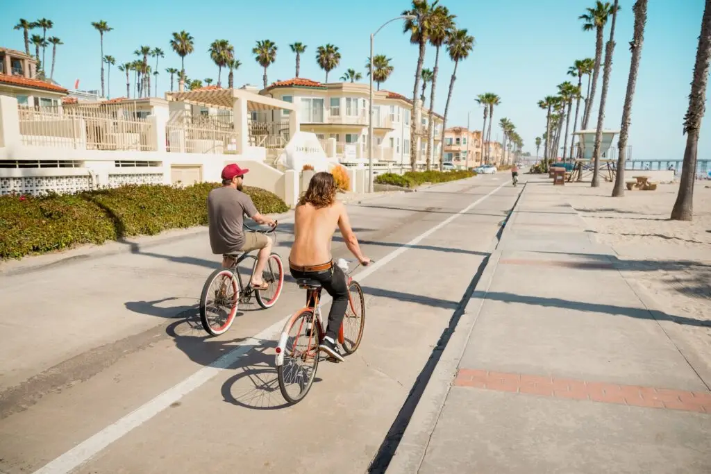
Growing up in Carlsbad, I never quite understood why people vacationed there. What, so you want to check out the field where I have soccer practice? Pay my orthodontist a visit? Carlsbad just felt like a town by the beach, no better or worse than any other in the country. It took going to college out of state for me to actually understand just how rare a place like Carlsbad is.
Thanksgiving break my freshman year, my first time coming home after three months in the Midwest, my shoulders dropped. I rolled down the windows and drove to lifeguard tower 37—the hangout magnet for Carlsbad’s youths (and, in the summer, tourists)—and the smells of the ocean woke me right up like smelling salts do. I finally got it.
Carlsbad isn’t just a stopover town on your way to something better. It is the destination. Travel + Leisure named Carlsbad one of the top 50 places around the world to travel in 2026. From the whole globe, the travel magazine picked my home. Sure, we’ve got the Flower Fields and Legoland—but now it’s the smaller ships and indier dreams that are giving it street-level character.
It’s not just Carlsbad, either. People have talked about the “North County bubble” for decades—a force field that prevents its residents from traveling south of the 56. It’s often used derogatorily, and it’s a fairly accurate burn.
For decades, living up in North County meant giving up on culture, or at least culture within close proximity. But now, the main expansion of San Diego culture is happening up north. Central San Diego restaurants have started taking notice and are expanding into the area—spurred no doubt by Oceanside’s food boom and the Jeune et Jolie–Campfire–Wildland–Lilo constellation in Carlsbad. City Heights burger joint Key & Cleaver opened a new spot in Oceanside; the owners of Parc Bistro-Brasserie in Bankers Hill opened Parc Lounge in Rancho Santa Fe. Possibly the strongest market indicator is that Sam Fox—one of the most successful restaurateurs west of the Rockies—has started focusing on North County for his concepts. In 2025, he opened both The Henry in Carlsbad and Culinary Dropout in Del Mar.
For the ultimate insider guide, we found a handful of inspiring people who live and create and truly know six North County neighborhoods—San Marcos, Escondido, Oceanside, Leucadia, Rancho Santa Fe, and Vista—and asked them how they’d spend a dream day out and about in their town.
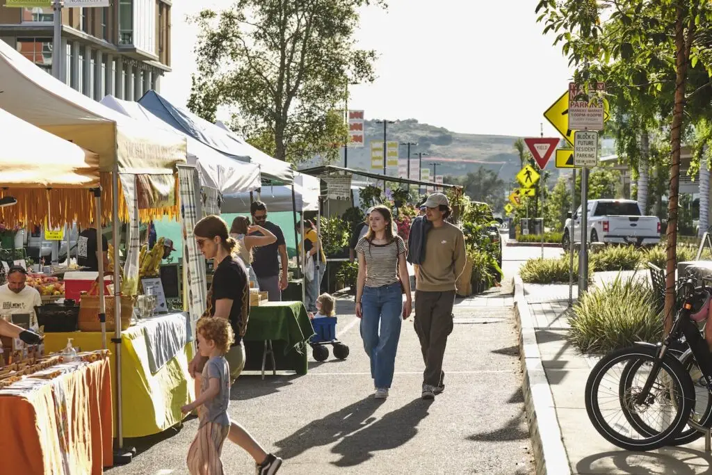
Courtesy of North City Farmers Market
San Marcos
San Marcos is in full renaissance mode. The biggest story is that the grand North City vision is starting to peek through the scaffolding. It’s essentially the North County Downtown that’s been written in the tea leaves and discussed whenever someone gets stuck in traffic at the 5/805 merge: a 200-acre, pedestrian-friendly, mixed-use face-changer that’s slated for 2,600 homes, 350,000 square feet of retail and restaurants, 250 hotel rooms, and about a million square feet of offices and labs. Its most recent manifestation is 222 North City—a 12-story residential tower with over 450 residences, rooftop garden, pool cabanas, art installations, and almost 20,000 square feet of ground-floor retail (Necessity Coffee, Buona Forchetta, Draft Republic, Milonga Empanadas, and a grocery store anchor on its way).
Which means Restaurant Row is no longer burdened with being the primary caregiver for the hungry or the socially inclined. Patricia Prado-Olmos has watched the city morph during her nearly three-decade tenure at CSUSM, having spent the past six years as the school’s chief community engagement officer. She also just announced her forthcoming retirement at the end of the 2026–2027 school year, so she’ll have even more time to haunt local haunts.
Meet the Local: Patricia Prado-Olmos
Those in the know call the university “Cal State StairMaster” from the Sisyphean amount of stairs on the hillside campus. So, any day at or around CSUSM should start with a homestyle carbo-load (biscuits and gravy) from Mama Kat’s.
“There’s something about this breakfast spot that immediately puts me in a good mood,” she says. Mama Kat’s is also known for its pie (strawberry-rhubarb), which is breakfast if you change your perspective.
After a few hours on campus—with a break to pet the university’s official therapy goldendoodle, Frank, who helps ease finals tremors or apprehension of on-campus stairs—Prado-Olmos will wander into North City, just steps away. She says the almond croissant and coffee at Christophe Rull Patisserie rival Parisian cafés: “It feels like the kind of place you’d stumble across in a much bigger city.”
Rull, a Michelin-trained pastry chef who’s done stints on Netflix (Bake Squad) and Food Network (Super Mega Cakes, Halloween Wars), opened his patisserie last fall. The hype hasn’t cooled off yet: Get there early because the crowds do.
Emma Veidt is an editor at San Diego Magazine. She earned her bachelor's and master's degrees from the Missouri School of Journalism. She loves running, hiking, and rock climbing, but really, she mostly loves encounters with the street cats around North Park.
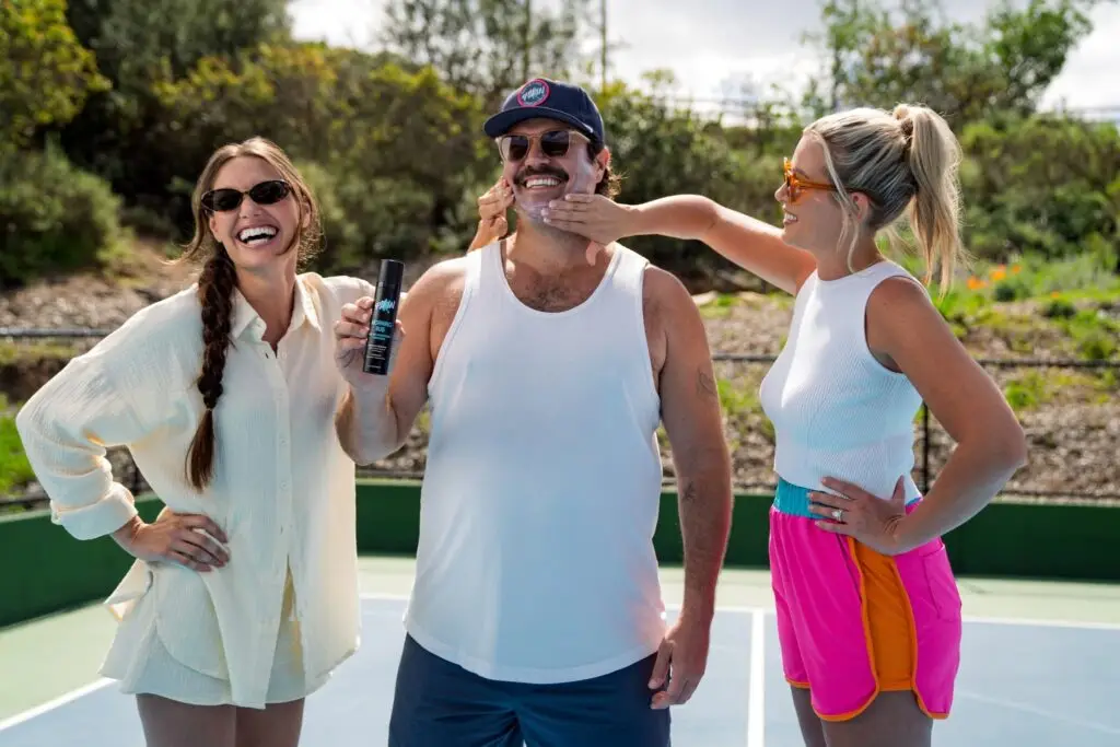
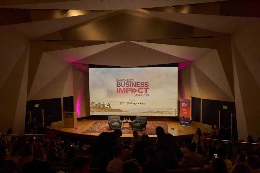
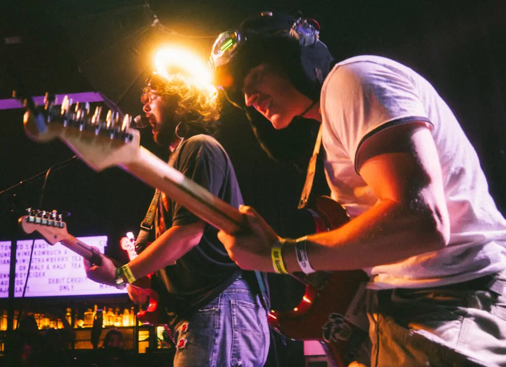
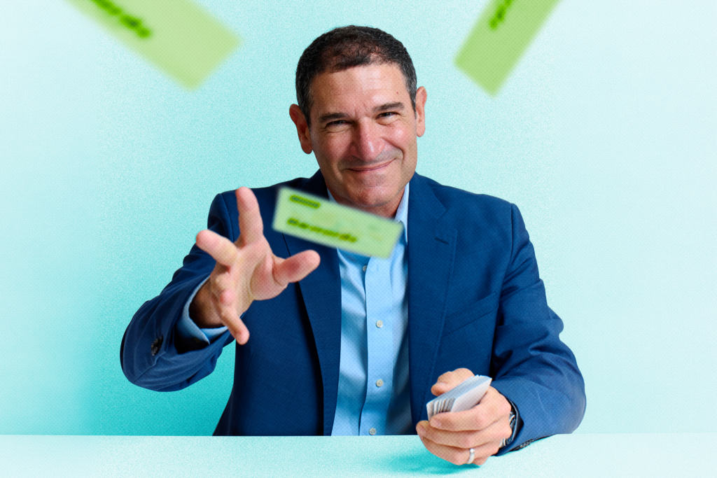
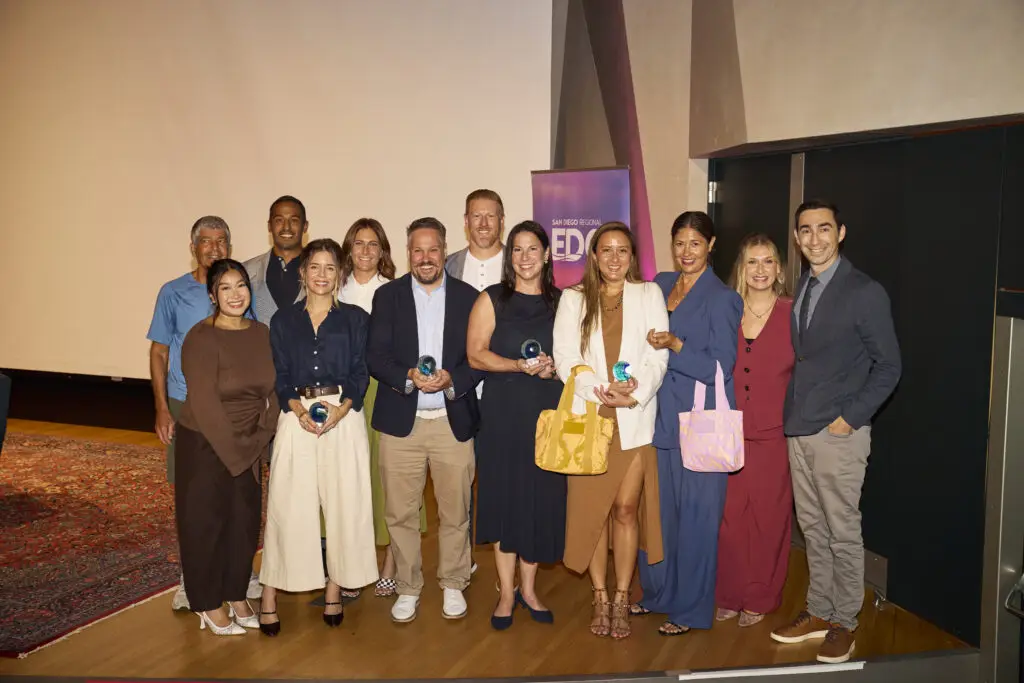
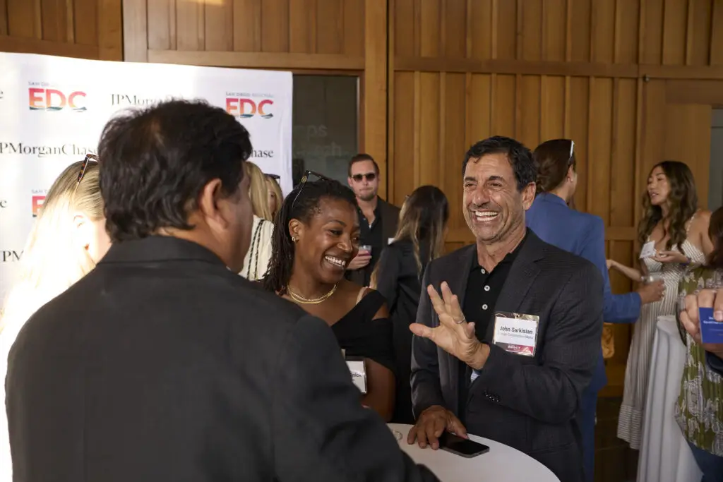
Renewable energy companies building hundreds of power plants. Biotech startups using artificial intelligence to create personalized medicine for children with rare diseases. Hospitality companies quietly powering thousands of local events. Consumer brands growing from beach-town startups into national businesses. These are the kinds of companies driving San Diego’s economy today, and the businesses recognized at this year’s San Diego Business Impact Awards offer a snapshot of where the region is headed.
Hosted July 23 by San Diego Regional Economic Development Corporation (EDC) and JPMorganChase, the second annual awards event honored four local companies for innovation, growth, and economic impact. More than 100 nominations from San Diego’s middle-market businesses were reviewed by a 10-person judging committee, with winners selected across four categories: startup, early-stage innovator, rising star, and established heavyweight.
Two-time honoree Jimbo Someck, founder of Jimbo’s organic grocery stores, also joined the event for a fireside chat on buying local, supporting emerging brands, and giving back to the community.
“San Diego’s strength comes from its makers and builders—the resilient people who endure great risks and overcome obstacles to build and scale a company,” says Aaron Ryan, San Diego Region Manager and Middle Market Banking at JPMorganChase & Co. “These awards aren’t just recognition; they spotlight the talent, grit, and innovation shaping our region’s future. By celebrating those who create and build, we foster connections and fuel the growth that keeps San Diego thriving.”
Matt Furman Photography
Building the Infrastructure Behind Clean Energy
Heavyweight honoree SOLV Energy has grown alongside the country’s rapid investment in renewable power. “It’s an exciting time for SOLV Energy as we are experiencing significant growth,” says CEO George Hershman. “The business has doubled over the last year and has almost double-digit growth since its inception.”
The Rancho Bernardo-based company designs, builds, operates, and maintains utility-scale solar and energy storage facilities. Since its founding in 2008, SOLV Energy has built more than 500 power plants.
Growth has translated directly into hiring. About 200 employees work from the company’s local headquarters, including roughly 20 interns. “Our intern program is a big part of the way that we grow our workforce,” Hershman says. “Last year, 43 percent of our interns became full-time employees. We believe San Diego is a great community to build and grow a high-tech infrastructure and technology company because of the incredible workforce—the ability to attract top talent and draw from world-class universities.”
Developing Medicine One Patient at a Time
Startup honoree La Jolla Labs is tackling one of medicine’s biggest challenges by developing personalized RNA therapeutics for patients with rare diseases—many of them children with neurological disorders like ALS. Using proprietary artificial intelligence and machine learning tools, the biotech company develops treatments tailored to each patient’s specific genetic mutation.
CEO Tamar Grossman says the recognition reflects how far the company has come despite limited resources. “We’re honored to be recognized for our ability to change and save patients’ lives and turn our lean startup into a clinical company with very minimal resources,” she says.
Grossman credits San Diego’s concentration of research institutions—including UC San Diego, the Salk Institute, and Scripps Research—with creating a pipeline of talent and collaboration. “San Diego is one of the world-leading centers for technology, genomics, and RNA therapeutics,” she says. “We have over 30 RNA therapeutics companies here, and we support each other and help with anything related to drug discovery.”
She says that collaborative spirit extends beyond formal partnerships. “You can walk around Torrey Pines, go into a café, and find colleagues from the industry and have an ad hoc conversation,” Grossman says. “That’s something very unique to San Diego.”
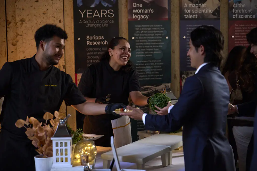
While Snake Oil Venue Company may not be a household name, chances are many San Diegans have attended one of its events. The early-stage innovator honoree has expanded from beverage catering and mixology consulting into venue management, operating Julep Venue in Mission Hills, Bramble Bay Venue in Imperial Beach, Vesper Venue, the Chapel at Liberty Station, and five outdoor venues throughout Liberty Station—more than 500,000 square feet of event space altogether.
“We do a lot of launch parties for corporations and new products,” says CEO Mike Esposito. “I really like working on the entrepreneur side of things, where new businesses are entering the San Diego market and looking to make a splash.”
Snake Oil has executed more than 16,000 events, employed more than 1,000 people, and partnered with more than 900 local vendors, including caterers, florists, photographers, entertainers, and other hospitality businesses. The company also works with many of San Diego’s nonprofits, museums, and cultural institutions. “We get to celebrate people’s most important moments,” Esposito says. “Whether that’s a wedding, celebration of life, or quinceañera, we’re fortunate to be involved in the community in so many different ways.”
Matt Furman Photography
Growing a Beach-Town Brand into a National Business
Rising star honoree ALOHA Collection is proof that a simple idea can grow into a thriving company. Founded by two roommates who wanted a better way to carry wet swimsuits after a day at the beach, the lifestyle brand has grown into a business while maintaining strong year-over-year growth.
Now headquartered in Carlsbad, ALOHA Collection employs more than 100 people and operates its California flagship store in Encinitas, which is slated for a remodel. With roots in Hawaii, the company is known for its lightweight, splash-proof travel bags that have become a familiar sight on beaches in San Diego and beyond.
“‘Aloha’ is part of our name, but it’s also how we move through the world,” says CEO Lynna Barnard. “It’s how we show up for people, the way we travel, the way we give back.” Since day one, the company has maintained a 5 percent giveback to Hawaii conservation efforts, contributing millions of dollars over the years.
“I think what’s so inspiring about ALOHA Collection, and the founders in particular, is when you dream big, those dreams can come true when you work hard and trust in the universe,” Barnard says. “It’s inspiring to be a role model for other people wanting to start businesses from humble beginnings. Start small and watch it grow.”
Together, businesses like these form a cornerstone of San Diego’s economy—not only through the jobs and revenue they generate—but through the local workers they hire, vendors they support, and investments they make in the region. Their growth doesn’t happen in isolation; it ripples outward, strengthening the broader business community and the people who call San Diego home.
I am fairly sure they don’t let you graduate from Carlsbad High School without a W-2 from Legoland. Being a Legoland MC (Model Citizen, the employee’s moniker) is a rite of passage for all of us who grew up in North County. If you spent a day at the theme park in the 2010s, I probably pointed you toward the Granny Apple Fries or measured your height at a ride entrance.
And now we meet again. I can still point you to quality fries.
This is my first full issue as the new print editor for San Diego Magazine. But it’s not my first time here: I was an editorial intern for these pages back in 2018 (see photo). To be a part of a constant study of the city, its people, its culture, then finding the most compelling stories and bringing them to life—it was incredibly impactful and solidified my decision to pursue all of this (local, print magazine journalism) as a career. Since my internship, I’ve gotten my bachelor’s and master’s degrees from the Missouri School of Journalism and worked for nearly five years at Backpacker magazine. And I’m back at San Diego Magazine, baby. There’s a real magic to narrating the lives lived and dreams dreamt in the place that built me. I am excited to be a part of building the culture of where I’m from. And, born in Tri-City Medical Center and raised in Carlsbad, I can’t think of any other place than our North County issue for me to make my grand entrance as an editor.
To me, North County isn’t just where I’m from; it’s home. Throughout the years, I have run thousands of miles (I did the math) up and down the 101 between Oceanside and Cardiff. I’ve spent thousands of dollars (an estimation, too painful to do the actual math) on BRCs—beans, rice, and cheese burritos—from Lola’s, Juanita’s, and the late, great Pollos Maria.
The stretch of land between Camp Pendleton and the 56 is easy to love. We’re quieter and a little more zenned out than our lower-latitude neighbors, sure, but we’re neither sleepy nor boring.
Do you think Scrojo, the Belly Up’s punked-out poster artist featured on page 68, could last a day somewhere boring?
What I’ve always loved about North County is that the culture shifts every couple of miles as you reach a new town. For years, the media seemed to cast the realm above the merge as a two-toned monolith: sleepy surf towns to the west, suburbs and country living to the east. The nuance of each section seemed flattened or clumped. I think you’ll see the vastly different cultures of North County in this issue—but all distinctly San Diego. Which is to say a little mellower, fewer airs, come as you are.
It’s hard to imagine that the dusty trails and vibrant, muraled alleyways of Escondido are just miles from the barefoot surfers roaming Leucadia. Even though the SDM editorial staff is made up of two lifelong locals and other longtime residents, we don’t pretend to be the experts on every street. What a good city media company does is find the people who are experts, who have a unique hyper-local perspective—and give them the stage.
So we picked six North County neighborhoods—Oceanside, Vista, San Marcos, Leucadia, Rancho Santa Fe, and Escondido—and reached out to artists, community leaders, business owners, anyone making their neighborhood brighter, and we had them describe their perfect day out and favorite things that give their neighborhoods meaning and culture. These itinerary curators included San Marcos’ Patricia Prado-Olmos, Leucadia’s Jeff Schade, Oceanside’s Aaron Crossland, Escondido’s Suzanne Nicolaisen, Rancho Santa Fe’s Charo Garcia-Acevedo, and Vista’s Steve Glaudini. If there’s anyone who lives and breathes North County, it’s them. Check out their recommendations in our feature on page 56.
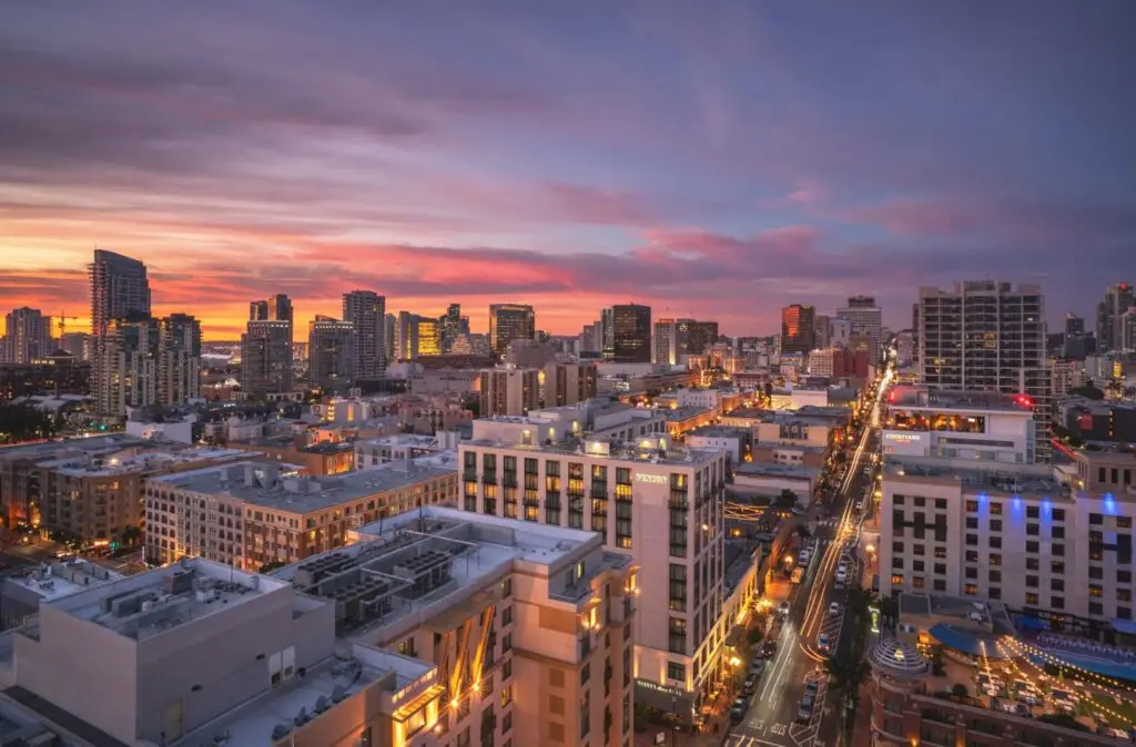
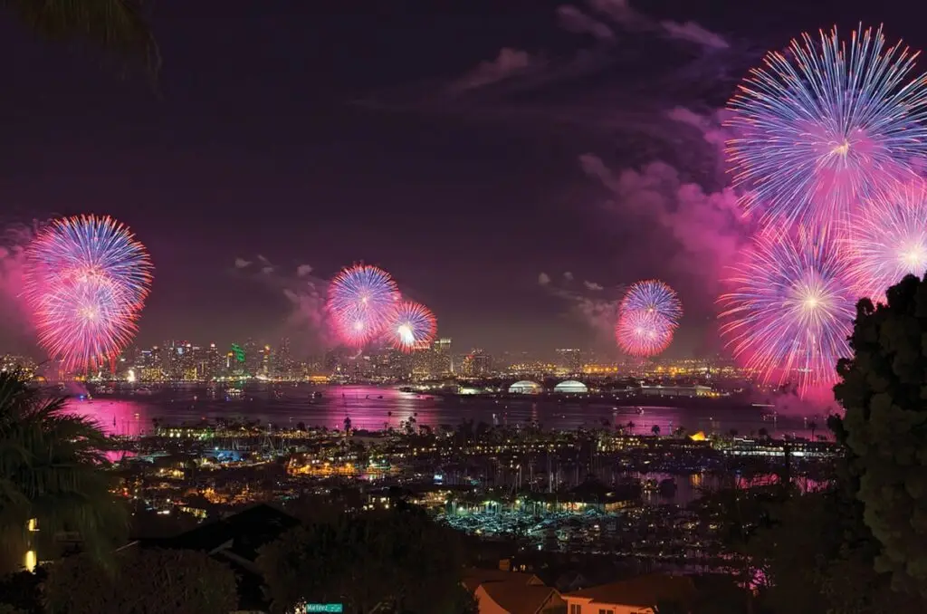
This month, we’re also going back in time almost 15 years to the Big Bay Boom. Yes, that meme-ified Fourth of July fireworks show where enough pyrotechnics for a 17-minute show went off at once over San Diego Bay. Content Chief Troy Johnson remembers the day and dug back through the story for a hilarious locals’ take on the big debate: Was it the worst fireworks show of all time, or the greatest? (Page 38.)
Before I leave you to our hard work, a sentimental note. When my parents moved from St. Louis to San Diego in the early ’90s, my mom subscribed to San Diego Magazine to learn about her new neighborhood. Now, over three decades later, I’m here—on this planet and in these pages. I thought about my parents a lot as we worked on this issue. Maybe there are a couple new San Diegans reading this magazine for the first time. Maybe that’s you.
Well then, to both of us, I say, “Welcome.” Let’s do this.
Emma Veidt is an editor at San Diego Magazine. She earned her bachelor's and master's degrees from the Missouri School of Journalism. She loves running, hiking, and rock climbing, but really, she mostly loves encounters with the street cats around North Park.
“This is insane!” the guy filming it seems to proclaim. “It’s the best fireworks show ever!” a companion confirms, inspiring a debate lasting over a decade.
All told, 7,000 fireworks exploded in the span of 25 seconds over San Diego Bay on July 4, 2012. A Michael Bay amount of unison. $125,000 worth of shells, cakes, Roman candles, and skyrockets had been placed on a barge—enough for 17 minutes of decorative sky flares—and…
Boom.
The sky looked like someone had set a giant Rorschach test on fire. Or as if whatever we all see in our Rorschachs—butterflies, clowns, tongue kissing, dads—was being electrocuted and lifted heavenward, amen. It was shocking how bright it was, how much it sizzled the local cosmos. Could’ve been one of those sci-fi films where a hole is ripped open between warring universes. But angstier, more metal—the work of some methy creator in a sleeveless concert tee.
The sound?
Lou Reed once released an entire album that contained 64 minutes of mindflaying guitar screeches and machine noises. No regular songs, just a fascinating amount of ear distress. His record label reps no doubt heard the melodic outro of their careers, but everyone else was in pain and stumped. That album still sounded better than the bay did that night. The bay sounded like a god who struggled with emotional regulation had blown his speakers and was working through the anger stage of AV grief.
In the left frame of the video, a middle-aged woman is attempting to drag her husband off by the hand. In no way does he want to go, possibly because he had missed the time Roseanne Barr sung the national anthem at a Padres game, simultaneously disemboweling and amusing America through the power of song. He would not willingly abandon an equally worthy San Diego trainwreck.
Another woman in the video appears to have just filled her beer, rushing to sit down for the show. She pauses mid-sit and returns to the full and upright position to properly bear witness. What was supposed to be prolonged entertainment has been so radically shortened that she will have to find another reason to drink. Lucky for her, drinking will be the only way to adequately process.
Locals remember the conspiracy theories. People wondered if the fuses had been tripped by a saboteur who was sympathetic to dogs, fish, or the growing suspicion that late-stage capitalism is a gorgeously branded but impossible dream sustained by remarkably efficient top-tier wealth retention and the soft compliance of fireworks-watchers who can no longer afford a house, a beer, or the personal impacts of human reproduction.
Speaking of being terrified of babies, babies were terrified. The children who witnessed it probably still can’t go near a candle store. But those kids will be tougher, perfectly scarred kids. They’ll write better songs.
That night helped us absolutely dominate the national news cycle. For a hot minute, we became America’s water-skiing squirrel. Now, years later, when you Google “fireworks gone wrong,” San Diego is always a top contender, along with that poor Nebraska family who nearly wiped out a couple generations in their front yard, their minivan somehow turning into a howitzer of recreational TNT.
There is still debate as to whether Big Bay Boom 2012 is the worst or greatest fireworks show of all time. But the advanced parts of civilization arrived at the truth as quickly as the women in the video did. It was undeniably amazing.
First of all, the point of Fourth of July fireworks isn’t “the intricate choreography of sky fire over a guaranteed amount of show time.” It’s about creating a vivid memory shared with some people you like, love, or would like to love.
BBB2012 used large-scale chemical fire to create the ultimate memory.
Sure, some people who iron their jeans subjected their family to a sermon about how San Diego managed to botch America’s birthday like a Disney princess-for-hire who smelled of quite a few Sauvignons.
The rest of us saw how perfectly it nailed the actual feeling of being an American. Because only a miniscule percentage of us bake postcard apple pies where every inch of crust is perfectly laminated like the wood in an Irish bar. Very few of us can paint on par with Picasso. The rest of us—despite truly believing in our America-activated abilities to achieve greatness in almost any field of our choosing—burn pies. We try to paint only to realize it looks like our fine motor skills have entered active death.
That’s why BBB2012 was the most perfectly American fireworks show ever: A wildly ambitious idea galvanized thousands upon thousands of people to both work on it and come to hold a beer and gawk at it, only to have it fail in the most glorious TMZ-level spectacle.
America isn’t about immaculate, storyless wins. It’s about how the framework of a country is solid enough that we can accidentally detonate our entire lives—a few times—and still probably be OK.
No one has America’d quite like San Diego did on that day. It was performance art. Lou Reed’s heart slow-clapped. Any brief municipal embarrassment quickly became a pride of our people. I can only hope the same for the Nebraskan yard family whose Dodge Aerostar became a hyperactive Death Star.
P.S. Local writer Maya Kroth compiled a quite great oral history of that night for Thrillist. The bottom lines for me were—it took nine months to prepare, no one was hurt, and even though the pyrotechnics company tried to zero out the bill, Big Bay Boom founder H. P. “Sandy” Purdon refused and paid them in full. This year will mark the 25th Anniversary of the yearly Big Bay Boom.
Troy Johnson is the magazine’s award-winning food writer and humorist, and a long-standing expert on Food Network. His work has been featured on NatGeo, Travel Channel, NPR, and in Food Matters, a textbook of the best American food writing.
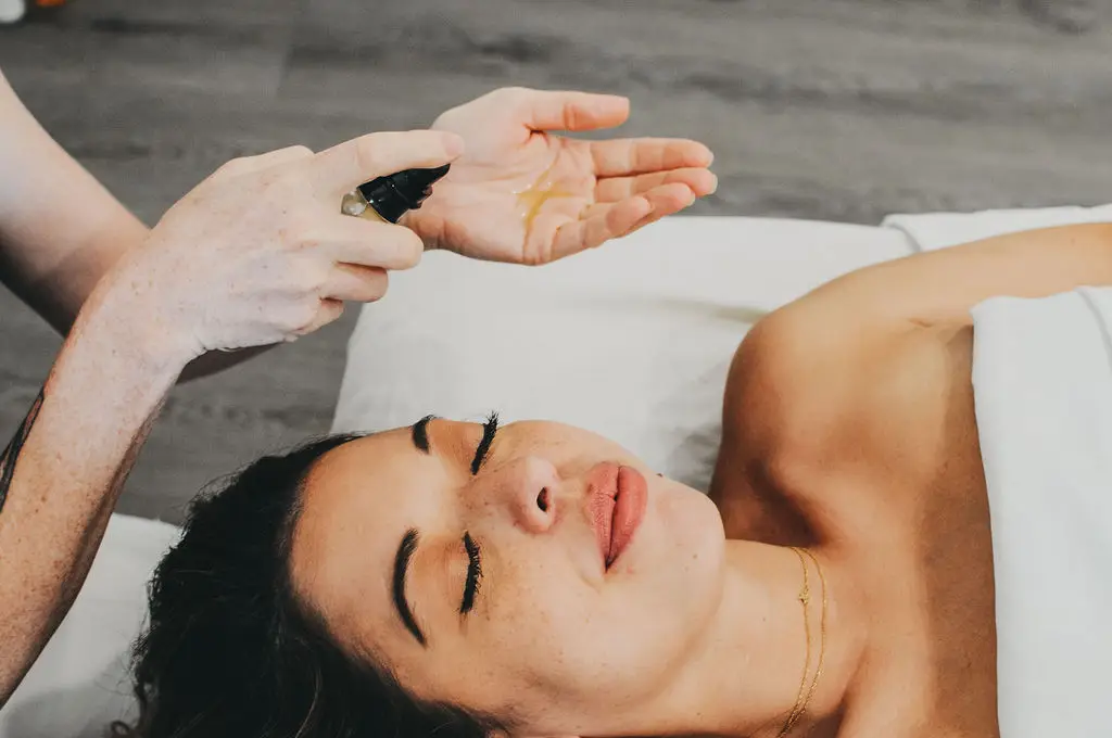
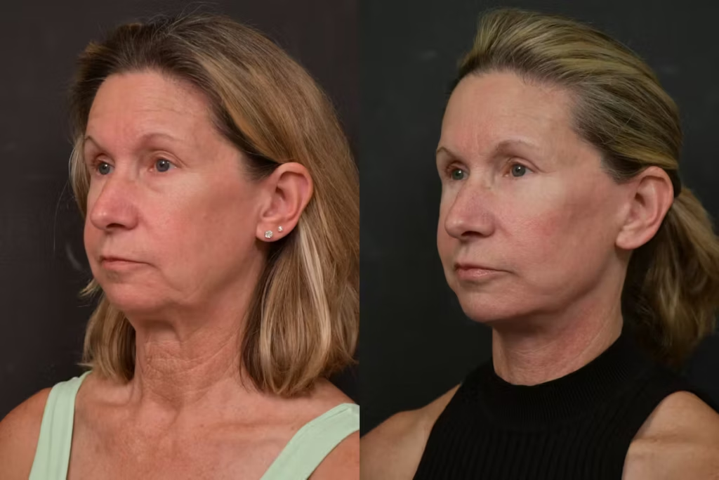
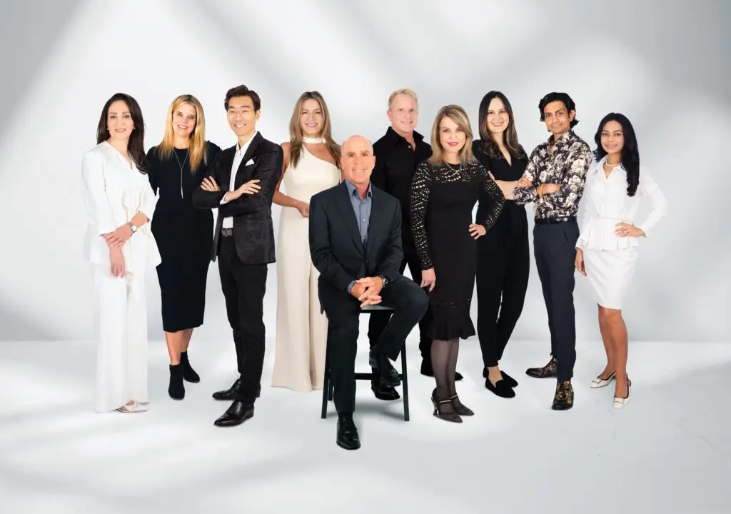
San Diego is home to world-class aestheticians, plastic surgeons, and dermatologists who can help turn back the hands of time and revitalize tired, damaged skin. Enhancing your look is a spectrum. Treatments range from noninvasive procedures like lasers or injectables to the big guns, like a deep-plane facelift—many with better results and less downtime than ever thanks to advanced techniques and technology. Whether you’re a Botox beginner or an aesthetic medical care veteran, San Diego aestheticians and aesthetic medicine providers can help you look and feel like the best version of yourself.
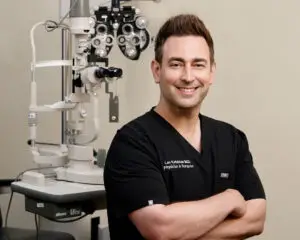
Changes Plastic Surgery & Spa
Changes Plastic Surgery & Spa is San Diego’s premier destination for aesthetic surgery, led by world-renowned plastic surgeon Dr. Michael Rossi. Celebrated for his artistry, precision, and natural-looking results, Dr. Rossi is known for creating customized Mommy Makeovers that help women restore confidence and reclaim their bodies after pregnancy. His expertise also extends to comprehensive post-weight loss body contouring, addressing excess skin and skin laxity with sophisticated surgical techniques tailored to each patient’s unique anatomy and goals. From breast and body rejuvenation to deep plane facelifts and eyelid surgery, every treatment plan reflects Dr. Rossi’s commitment to surgical excellence, personalized care, and transformative results that look as beautiful as they feel.
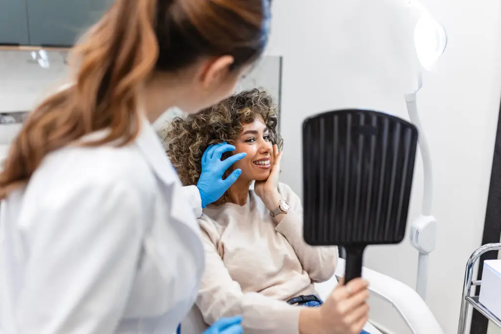
Cosmetic Laser Dermatology
At Cosmetic Laser Dermatology, the board-certified, internationally acclaimed team has the power to erase 10+ years of aging in a single treatment. The center’s 60+ laser, light, and energy devices do it all—refining texture and tone, calming acne, minimizing pores, and erasing that ill-advised spring break tattoo of yesteryear. Their dermatologists take it further by stacking multiple devices in one session for synergistic results—the philosophy behind their signature Take5 and Take10 treatments, the latter capable of removing a decade-plus of aging in just one visit. Add a full suite of injectables, body sculpting, and vein treatments for every skin type and tone, and it’s no wonder the practice’s medical director was named the #1 cosmetic dermatologist in America by Newsweek two years running.
Cultivé Medical Aesthetic
If it’s subtle, lasting results you’re after, Cultivé Medical Aesthetics has you covered. Cultivé purposely combines aesthetics and wellness. The Bankers Hill practice offers a full menu of services designed to improve skin health and support the three pillars of aesthetic aging: skin tone and texture, volume loss, and laxity. Cultivé offers a wide range of aesthetic treatments, including collagen boosting powerhouse Morpheus8, biostimulators like Sculptra and Radiesse, PRP therapy, laser hair removal, VI peels, and regenerative skincare treatments. They also provide wellness-focused services such as hormone replacement therapy, IV therapy, and medical weight management programs.
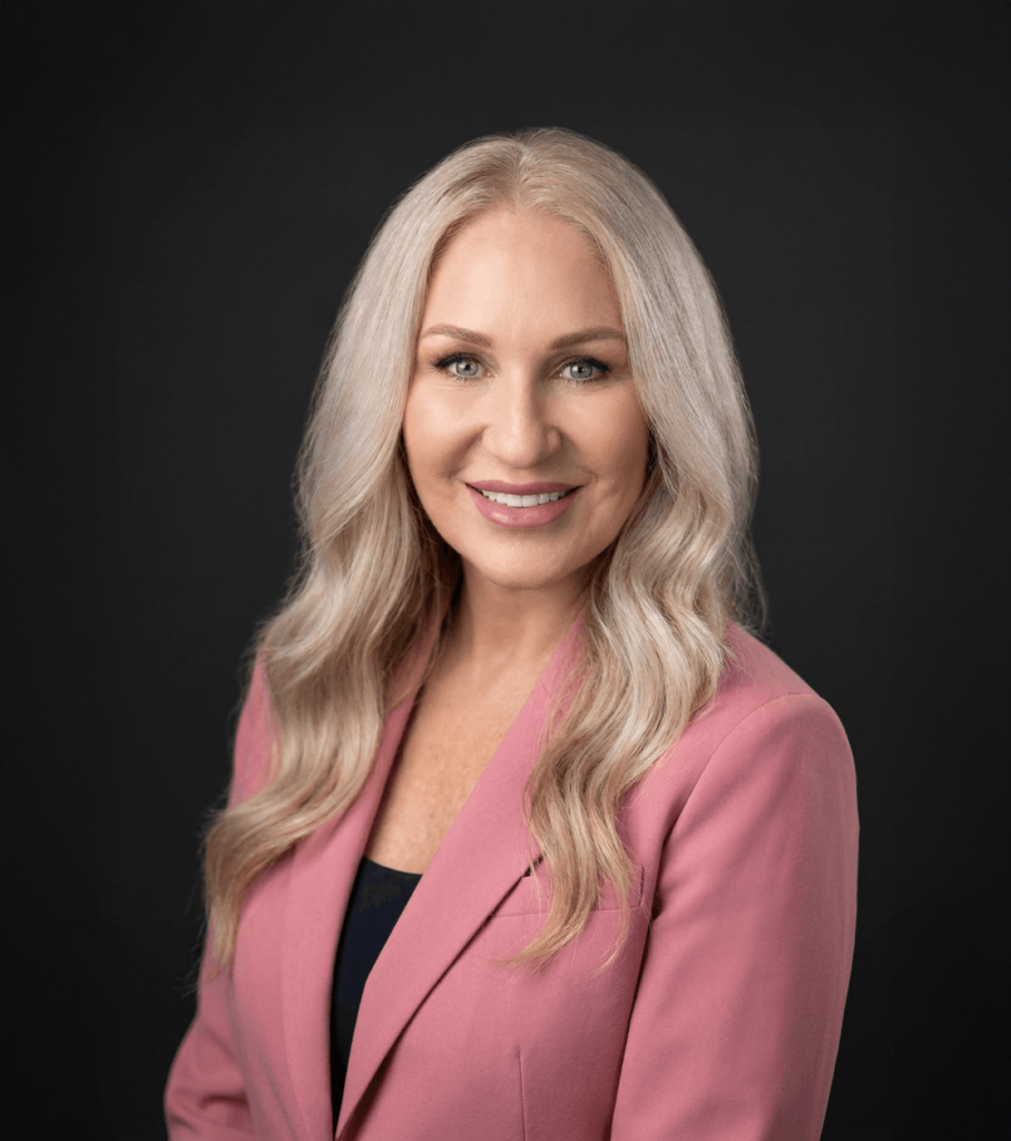
Starlite Aesthetics and Wellness
Starlite Aesthetics and Wellness focuses on enhancing natural beauty through science-backed treatments tailored to each client’s goals. Michelle Langston, MSN, APRN, FNP-BC, founded Starlite on the principle that aesthetic medicine should be precise, personal, and rooted in wellness. The boutique aesthetic practice in La Jolla combines modern medical aesthetics with holistic wellness principles for refined results personalized to each patient. Langston has spent more than a decade honing her skills in advanced injectables, regenerative therapies, and anti-aging care. Starlite offers regenerative therapies rooted in science, promoting skin rejuvenation using a multiple modality approach. Service offerings include RF microneedling, wrinkle relaxers, facial balancing and more.
The “It” List
In the rapidly advancing field of aesthetic medicine, it can be hard to tell what’s worth the hype. Here are some of the latest, most advanced, and most popular options out there.
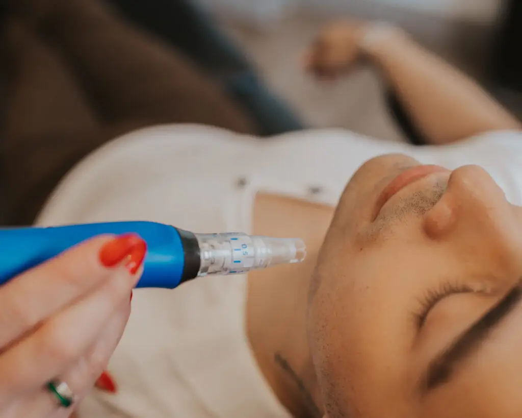
Morpheus8: This combination of microneedling and radiofrequency (RF) energy activates your skin’s own collagen and elastin without the downtime associated with some laser treatments. It can be used to reduce wrinkles, tighten skin, improve skin tone, contour the jawline, and minimize acne scars.
Exosome Therapy: This cutting-edge treatment uses protein-packed nanoparticles to trigger repair and rejuvenation at the cellular level. Often used post-microneedling or lasers, exosomes penetrate deep into the skin to stimulate collagen production.
Post-GLP-1 Skin Removal: Rapid fat loss prompted by GLP-1 medications, including semaglutide, tirzepatide, and retatrutide, can leave users with sagging skin. Skilled surgeons can remove excess skin and reshape the figure.
Treatment Stacking: Sometimes it’s the more the merrier when it comes to aesthetic procedures. Combining multiple non-surgical treatments in a single session allows users to address several issues efficiently, with less downtime.