


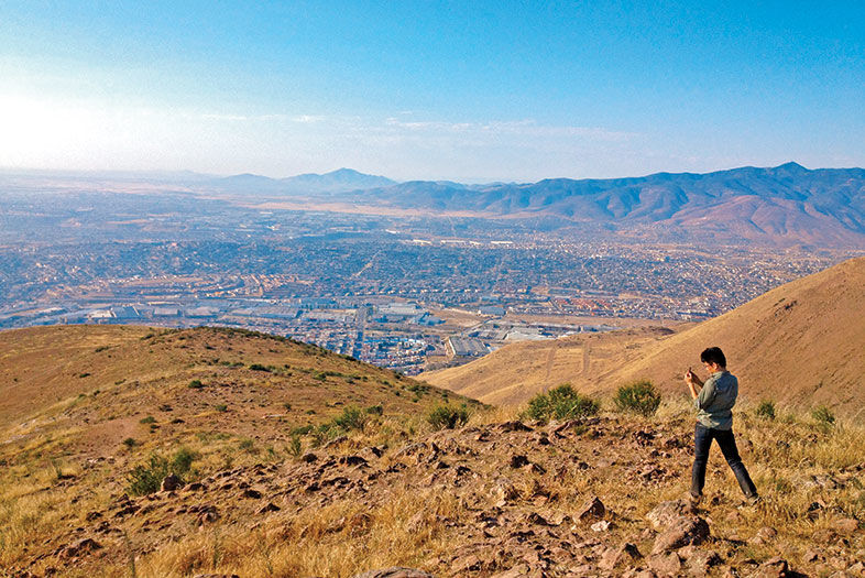
The border city offers several remedies for fiebre de cabaña (cabin fever), both on and off the beaten path. Cerro Colorado—which, at 1,800 feet, is Tijuana’s highest peak—is easily recognizable thanks to the giant whitewashed stones spelling out “Jesucristo es el señor” (Jesus Christ is Lord). The hill is 15 minutes from the Otay Mesa border crossing. Reaching the summit takes 30 minutes via the medium-grade trail on its north side, but getting to the base—hidden in the back roads off Boulevard Manuel J. Clouthier—is the true challenge. The 360-degree vistas stretch from Rosarito to downtown San Diego, making any hassle in getting there worthwhile.
Or break a sweat at Crea—Tijuana’s outdoor municipal sport complex, between city hall and the Hospital General Tijuana in Zona Rio. The city estimates that 1,000 people show up daily to race around either the inner 900-meter synthetic track or outer 1.5-kilometer trail.

In 2010, new wood planks replaced the pockmarked cobblestones along the Playas de Tijuana boardwalk, transforming the 3-mile loop that stretches from the border fence to the lifeguard station from a twisted-ankle minefield into a jogger’s delight. Locals call it “el malecón” (the boardwalk), a favorite among runners despite the everyday obstacles: churros vendors, loose Chihuahuas, and the occasional crew of clowns.
Runners, take your mark! The website “Yo También Corro en Tijuana” (I Also Run in Tijuana) chronicles upcoming races in the city, from fun runs to marathons.

Hiking Tijuana
